Wednesday, December 31, 2014

Blue Goose ~ Day 214

December 27, 2014 ~ Laredo, TX to Alamo, TX

I drove east through the old, old town of San Ignacio and then through Zapata where I ate leftovers in my car and watched the canebrakes around the small pond adjacent to the town library, another White-collared Seedeater hot spot, and waited for the one chance in a thousand that they would appear, too lazy to even get out of my car.
San Ignacio, TX

I turned off the highway into Salineno, another small, old town on the Rio Grande, because a tiny piece of the Lower Rio Grande Valley NWR is here.  

WWW.FWS.GOV
Since the 1930s, 95 percent of the native habitat found within the Valley has been cleared for agricultural or urban development.  This development has relegated native plants and animals to remnant tracts, possibly compromising the genetic integrity of many species. Hoping to connect and protect these isolated tracts of habitat, the Lower Rio Grande Valley National Wildlife Refuge was established in 1979 with a management priority to protect biodiversity.  As a wildlife corridor, the refuge follows the Rio Grande along the last 275 river miles, connecting isolated tracts of land managed by private landowners, non-profit organizations, the State of Texas, and two other National Wildlife Refuges, Laguna Atascosa and Santa Ana.  

A couple from Grand Rapids, Michigan, Pat and Gail DeWind owned a little place down by the Rio Grande in Salineno and fed birds for a couple of decades before selling the property to the Valley Nature Fund (or donating it and maybe they weren't from GR, although I'm certain I read that somewhere lately; at any rate, they were from Michigan).

I don't think it's easy to find definitive information about Salineno, but I remembered it well from a trip in 2011. However, when DHC and I stopped by in 2013, there was nothing here. So I went only for a Lower Rio Grande Valley NWR visit and was pleasantly surprised to see the feeders were up and running! I was told that everything stops at the end of March which accounted for the lack of anything here early in April last year.

One other guy was there with his long lens, digiscoping, when I arrived. Of course, I settled in for awhile (until it began drizzling) and had a pleasant conservation with two of the gentlemen volunteers as mostly flashy birds flew to and from the 20-30 feeding spots: Altamira and Hooded Orioles (I missed the less frequent but also daily Audubon Oriole), Cardinals, Pyrrhuloxias, Orange-crowned Warblers, four dove species, Kiskadees, Green Jays....dozens of Red-winged Blackbirds, Golden-fronted Woodpeckers....and one lone Dickcissel in with the House Sparrows, very unusual this time of year at this spot. This was 30 minutes' worth of watching.
Altamira Oriole - Salineno - TX

I hung out on the actual bank of the Rio Grande for another 15 minutes, hoping for a Ringed Kingfisher with no luck.

After I left Salineno, I saw 35 law enforcement vehicles in the next hour, parked along or near the highway or at intersections. The next day I saw a dozen more early in the morning. I learned later on the news that a murder suspect had been apprehended Sunday in the area but have no idea if this was the reason for all the police cars.

I stayed in a Walmart in Alamo and ate tacos in a small taqueria across the street, with a warm pina colada type drink (no alcohol) which I remembered from a previous visit and which was "on tap." The taco plate came with a baked potato with cheese, sour cream and bacon bits and a generous side of gently fried onions. It began raining during the night, just as predicted.

Salineno, TX


Blue Goose ~ Day 213

December 26, 2014 ~ Pearsall, TX to Laredo, TX

A funny thing happened on the way to Laredo. There is a maneuver called the Hawk U-Turn. One is traveling at 65 mph (or in Texas, at least 75 or even 85 mph), spots a hawk on a telephone pole and makes U-turn to confirm an ID if necessary, not always easy on a limited access road or a road with marginal / no shoulders. I saw a large dark hawk perched on a pole along I35 which didn't look like a Red-tail. I checked my field guide There weren't many possibilities, but one was the Common Black Hawk which would be rare. Here is the unfortunate part: I let it go; no HUT. And while browsing Texbirds the next day there was this post from a guy:

Subject: Common Black-Hawk, Webb County
Date: Fri Dec 26 2014 20:00 pm
From: scott.rubio AT gmail.com
Observed two Common Black-Hawks at my cousin’s ranch today near Encinal,TX...They can be seen from the MartiƱena road just outside of town. Driving east from I-35 just after the bridge they have been seen sitting on the telephone poles.

Right where I saw a large dark hawk. I am not counting it, and there is always the possibility it is an incorrect ID, but still.... I didn't check it out because I WAS on the interstate, because there are hundreds of hawks down here, and because there are times when I am sick of birds.  

I found a Starbucks in Laredo, full of handsome, attractive Hispanics of all ages, a very different demographic than those living in the poorer neighborhoods closer to the river that DHC and I drove through when we were here last spring. Many vehicles have license plates from Mexican states. The whole border business intrigues me....

The weather was like a perfect Michigan summer day, 75 - 80 degrees with sunshine. 

I went to see the movie Wild in a huge mall. I walked at least 1/4 mile just to get to the theater, through major crowds, all Hispanic-speaking. There were occasional shoeshine stations in the corridors, each seat occupied by Hispanic men getting boots and shoes shined. I was probably the only monolingual person there. All was festive and cheerful as people shopped the post-Christmas sales, many young couples and families with their kids.   


I had read Wild (the book) by Cheryl Strayed, a nonfiction account of her 1000-mile hike on the Pacific Crest Trail. Both book and movie are good. Reese Witherspoon plays Cheryl and looks exactly like my SIL Stephanie in this movie...so much so, it was uncanny. 

It was still balmy and sunny outside after the movie. Since my van was almost in an Olive Garden parking lot, I ate there, which was busy even at 4:30 in the afternoon. The food was so-so. Lately, the salad is the best thing on their menu. 

I had intended to bird a bit in this area, trying to find White-collared Seedeaters which are tiny, secretive birds with thick bills. DHC and I sort of looked for them, driving and peering into 10-foot high, dense canebrakes last April until the Border Patrol came along and gently suggested we leave for the night and "come back in the morning when there will be more people...." 

It was too late to poke around after I ate. The next morning was grey and cool and I just knew the birds were huddled out of sight, so I left without even making an effort.  


Sunday, December 28, 2014

Blue Goose ~ Day 212

December 25, 2014 ~ Georgetown, TX to Pearsall, TX

Christmas Morning...Was I Blue?  A little, but this is one-time deal; I celebrated the holiday season with memories of Christmases Past...all good.

I was close to Balcones Canyonlands NWR and found it easily about 30 miles southwest of Georgetown, but didn't do more than turn into a small parking area / trailhead in one place and into the entrance / locked main gate down the road.
Balcones Canyonland NWR - TX

Balcones is a relatively new refuge in the hill country of central Texas on what is called the Edwards Plateau and is the breeding grounds of two birds. The protection of habitat for both is one reason this refuge was established: the "endangered" Black-capped Vireo with only three breeding populations in the US, and the "highly endangered" Golden-cheeked Warbler which only breeds in this area.

Balcones is also "...one of 14 dedicated Land Management Research and Demonstration Areas where new habitat management techniques and approaches are developed, implemented and showcased."

 WWW.FWS.GOV
Land Management Research and Demonstration Areas (Demonstration Areas) are managed by the U.S. Fish and Wildlife Service on national wildlife refuges and wetland management districts throughout the country.  They serve as institutions of investigation, innovation and instruction in wildlife and habitat management.

The [FWS] Service is uniquely qualified to demonstrate land management techniques that provide healthy, sustainable habitats for fish, wildlife, and plants. Its 95-million-acre National Wildlife Refuge System provides an unequaled backdrop for study and development of new techniques. With its “wildlife first” emphasis, the System is the only Federal network of lands dedicated to wildlife conservation and habitat management. Habitat management research is a tradition on national wildlife refuges. Since the establishment of Pelican Island Refuge in 1903, refuges have continually tested and refined management techniques.  Methods such as wetland restoration, reforestation, and prescribed fire have been used and improved on refuges for more than 100 years.

At each of the 14 Demonstration Areas, a specialized biologist oversees the research, development, and testing of new management techniques. Through wildlife inventories and habitat monitoring, the site becomes a repository of data and information about its featured habitat or management issues. Refuges with similar habitats or issues serve as test sites for identifying site-specific variables that may affect new methods. [bolding mine]
I suspect these quotes are often not the most interesting to read, but they do tell of the mission, direction and future plans of the NWR system with its 95 million acres and counting....
Balcones Canyonland on Christmas Day - TX

Since neither the warbler or the vireo are here in the winter, and because I have been lazy of late as far as moving/walking/hiking, I drove on through the lovely juniper-ash hills and small canyons of the Edwards Plateau which certainly did not fit the mental image I've always had of Texas. Interestingly, I just read that there are "no natural lakes in central Texas, mostly because it was not glaciated," but there are caves and springs, the Edwards Aquifer and reservoirs created by many dams. It is not arid here.

I was surprised at the traffic on this holiday as I moved south through Austin and then San Antonio on Interstate 35. It made me smile to see a vehicle with a Christmas wreath or big red  bow on its front. I found a station of classical Christmas and listened to parts of Handel's Messiah at full volume for an hour. The brilliant afternoon sunshine enhanced the beauty of this lovely music.

I thought Laredo was closer than it was and still had 100 miles to go when I decided to stop and got a dismal motel in Pearsall. I can't figure it: many motels are no more than half full (if that) but I still can't get much a deal. Priceline works occasionally, but usually their deals are discounted because those motels have issues. And once reserved, there is no backing out; one is committed. I drove through Pearsall looking for someplace to eat and settled for a gas station sandwich, either chicken salad or egg salad, or maybe a combination. It was difficult to tell.

The sun set in glory in the southwest, filling the sky with color.

Saturday, December 27, 2014

Blue Goose ~ Day 211

December 24, 2014 ~ Sweetwater, TX to Georgetown, TX

Christmas Eve Day...weird to be in the middle of Texas. I drove most of the day, although I spent at least a couple of hours in small towns trying to get a package of presents wrapped and sent to the SODAs, first in Santa Ana and then in Bangs. The deal was that the post offices close for lunch for one or two hours. I finally just stayed until the Bangs, Texas PO opened and cleaned out my cooler while I waited. There are thousands of small towns all over the country...like Bangs, the good ones evoking a time gone by, towns without Walmarts or Olive Gardens or Starbucks or Best Buys or McDonalds....towns with neatly kept houses and yards, porches, mature trees, no sidewalks, gardens, one grocery store, a few other businesses, usually a school, churches, sometimes a train station...a small post office. On a warm sunny day, these places always slow me down...in a good way.

In Texas even the country two-lane roads with no shoulders at all often have speed limits of 70, and the interstates vary from 75 to 85, so that slowing to 60 through the big cities is like super slow, making the congestion and lane changes seem easy.

It was sunny, so unlike a Michigan winter day. Of course, there was no snow.  Leaving the high plains in the west, I was in the hill country of Texas, the Edwards Plateau, with green lawns again after several weeks of dirt or xeriscaped yards, which did remind of a spring or summer in Michigan...the small towns, the rolling landscape and hardwoods like oaks (not the same oaks we have in Michigan), cypress, sycamore, pecan, madrone, black cherry...

By the time I leave Texas, I will have driven close to 2000 miles in this state. It's huge.
West Texas

This morning, I read all the posts about a Common Crane first seen in northwest Texas in late November, which stayed in the area about two weeks. This may or may not have been (and maybe there were two cranes seen) the crane which moved west to Roswell area. It was interesting to read of people driving from all over Texas to try to see this rarity. Most did. Here is a post about one search posted on Texbirds:

Subject: Crane chase (longish)
Date: Sun Nov 23 2014 10:43 am
From: dmarc-noreply AT freelists.org
...We settled in at Paul's Lake on the refuge to wait out the crane...Martin Reid showed us some maps and pointed out a route to search, so we echanged phone numbers with several other searchers, including Ed Wetzel who kept vigil at the lake, and set of scanning the thousands of cranes in the area. ...After quite a bit of scanning large flocks of cranes, we went to the CR1181 playa only to be overwhelmed by the incoming cranes. We and several others scoped every crane we could until we tired of the exercise....After lunch in Muleshoe, we went back to Paul's Lake where Ed still held watch. Many new chasers arrived. There were thousands of cranes loafing on the far shores and so we set out to walk around the lake to get a better look. As we were walking back to the crowd scene, a big blue SUV came screaming up the road followed by another car and another and another etc. We knew the chase was on! We sprinted to the road to hear where they were going and Martin shout out his window CR1181!!!! The next few minutes resembled a scene from Dukes of Hazard as we followed the caravan of vehicles exceeding reasonable and prudent speeds and fishtailing on the turn onto the dirt CR1181. Cameron Carver had located the crane and made the phone call and soon about 40 of us were sharing scopes, clamoring into truck beds and climbing onto SUV's for a better look. This bird is  about 20% larger than the SACR's, is quite handsome and shows very typical markings and bill color for Common Crane with no asymmetry or other signs of hybridization....I always love these chases...

It was not a night to spend in a parking lot, so I got a motel in Georgetown, north of Austin, and read a zuzu book, eating Saga cheese and crackers. It wasn't so bad.....


Friday, December 26, 2014

Blue Goose ~ Day 210

December 23, 2014 ~ Hereford, TX to Sweetwater, TX

The wind was blowing hard when I woke up and the van was rocking, but the rain/snow had passed and there was no ice, except once later in the mooring when a semi passed me at high speed throwing off large chunks of it from the top of his truck, which crashed into my windshield, not doing any damage...but startling me.

So my day began like many of them do: me and a table of local guys and a few other lone drifters hanging around McDonalds. I had awakened at 4:14 and the sun didn't rise until 7:30 so I had three hours before I started driving. (I am now again on Central Time.)

I have been wearing the same clothes for a week: a pair of black jeggings and a nice shirt I bought in Arizona. I do change underwear though if anyone is curious about that and half the time I have intimate clothing in my purse. I dug out my Uggs which are cozy warm and easy to drive in. I took too many clothes but am slowing using 75% of them as the weather and temperatures change.

I had this rule to stay where it gets 50 degrees by noon; lately I am pushing that boundary. I need to head south. But first today, I went to Buffalo Lake NWR not far from Hereford. Unfortunately, the water that originally was available for migrating waterfowl is no more, and the refuge is now managed for creatures adapted to living in arid landscapes, with a few windmills bringing up some water for them.

Buffalo Lake NWR - TX

WWW.FWS.GOV
Tierra Blanca Creek and natural springs fed Buffalo Lake for decades, until the 1970s. Irrigation and urban water pumping sapped the water table and simultaneously, the rains decreased. Tierra Blanca Creek dried up and eventually so did Buffalo Lake. After a torrential rain filled the lake to capacity in 1978, Umbarger Dam was condemned and the lake drained. In 1992, the Fish and Wildlife Service replaced Umbarger Dam with a modern flood control structure. Major storms occasionally flood Tierra Blanca Creek, but water quality suffers from upstream cattle feedlots. The refuge manages the dry lakebed for wildlife habitat. [Underlining mine.]

It's still a refuge, just not as much as it was, having lost the water fight.

I drove the 11-mile auto route in a strong wind, seeing a Red-Tailed Hawk, a couple of Kestrels, meadowlarks and four White-tailed deer.

The people at Bitter Lake told me I should visit Palo Duro Canyon, near Amarillo, part of the eastern escarpment of the Llano Estacado. So I did.
Palo Duro Canyon - TX
They were highly enthusiastic about its beauty; it is known as the "Grand Canyon of Texas" and is an area full of cowboy and Indian history: Charley Goodnight and the John Adair (JA) Ranch were some of the cowboys, and the Comanches and Kiowas the Indians who were finally subdued and placed on reservations. Mr. Adair was from Ireland and Charley managed the ranch. At one time it covered parts of six counties with over 1.3 million acres and 100,000 cattle. Here is another thread I could follow for hours but this information came from Wikipedia. Adair descendants still run the ranch. I am adding a Charley Goodnight biography to my reading list. I think he is third or man I've encountered on this trip that requires further investigation. I also bought the book Empire of the Summer Moon: Quanah Parker and the Rise and Fall of the Comanches, the Most Powerful Indian Tribe in American History (author S. C. Gwynne), another strong recommendation by the people I met at Bitter Lake.

Llano Estacado - TX
It is amazing to be driving on the Llano and suddenly come to this huge stunning red-rock canyon. A road goes to the bottom where there are many hiking trails and camp grounds. The wind was fierce today and there were no obvious birds, but apparently it is a avian sanctuary much of the year. While it is a grand canyon, nothing in the US compares to the Grand Canyon of the Colorado River. I would have hiked a few miles in better weather. There were five dips in the road marked as "Water Courses" with measuring rods firmly fixed in place and warnings not to drive through if the level was over six inches.
Water course #4 in Palo Duro Canyon - TX

The rest of the day I drove south, back on the Llano, dropping off to the west of Sweetwater where I stopped for the night. This was the day I was in a McDonald's three times, all for kind of wimpy reasons like food cravings, Internet access and no other suitable nearby restaurants. I was seeing holiday travelers with their sleepy small children again...."No, honey, we're already half way..." or a little Asian boy barely awake on his feet, looking blankly around the restaurant. Another dad was carrying a small child and a tray of food when the open liquid on the tray tipped and spilled on the floor. He was frantically trying to keep a firm grip on the child and prevent further spillage which only made the situation worse.

It was still windy but I stayed up later and thus slept later, waking in light for a change.

Blue Goose ~ Day 209

December 22, 2014 ~ Roswell, NM to Hereford, TX

I WAS up early and went to a McDonalds until 30 minutes before sunrise. The forecast had been for temperatures in the 30s in the morning, but it was 50 degrees As I drove east, the sky reddened with a gorgeous pre-sunrise display.
Driving toward Bitter Lake NWR in the morning - NM

I went to the east side of the wetlands and got out my scope after finding a huge group of Sandhills. I looked as best I could through the flock, although some were hidden by various weeds, brush and marsh grasses. After 30 minutes, I moved on and found an even larger group slightly to the south, so set up again, looked carefully through a thousand birds and found the Common Crane. Once I saw a black and white something, I knew what it was and focussed better to see it clearly. It stayed in that spot for an hour. I got a few blurry photos but it was too far for any detail. A man and woman drove up and asked if I had "seen the crane" so of course I was elated to point it out. After a couple of minutes of searching and trying to pinpoint exactly where, based on horizon features and telephone poles, they found it also. The guy lives in DC; the lady lives locally and was an active Audubon member. He used to work for USFWS and has a related job now in DC (lobbying?) and had a huge telephoto lens. His photos were much better but he acknowledged were not optimal as the crane was at such a distance.
Common Crane and Sandhills (Common is the black and white blob left of center)
 - Bitter Lake NWR - NM
Another woman from Arizona came and we talked about birding and her job teaching English at a boarding school for Native Americans. She was "chasing" also and had brought her college-age daughter and some of her students along. They were all back in the motel sleeping but had seen the crane yesterday feeding in the fields.

I still am amazed that this so often works: finding out about a rare bird, going to the venue and actually seeing it. But it does...
Snow Geese - Bitter Lake NWR - NM

I left Roswell at noon in bright sunshine with the temperature at 71 degrees and headed for Texas. Right before the border is Grulla (GRU ya) NWR and I wasn't going to stop there, but really, it was on my way and an excuse to get off the main road. I found the sign but the road was a narrow cut through fields, up a rise in the distance and full of tumbleweeds. The DC guy had said this was a small unremarkable refuge so I didn't check it out as, once again, the van is not really a vehicle for getting too far off-road. I continued into Texas (now on the Llano), and I could see to the edges of the earth in all directions. Today, there are ranches and some cultivated crops (cotton, for instance) but the sky still dominates everything. I often passed derelict abandoned homesteads of which there were many hereabouts.

The sky clouded with massive grey clouds that would have been more ominous in April. I drive in the turn-off for Muleshoe NWR but didn't go down that road either. It was getting too close to night, and I had an hour to drive yet. But I later read that the annual Christmas Bird Count (CBC) on Muleshoe this year yielded 72 birds. I'm sorry I missed exploring it.

The temperature had been dropping all day. It was now below 40 and still dropping and rain began. Great...I was in the worst conditions: rain, dark, falling temperatures, busy road and really no idea exactly where I would stay. So I pulled over and checked out Hereford when I got to the city limits and, yes, there was a Walmart which I found. I rummaged in the store a bit, getting a Subway sandwich for dinner.

I can't leave the windows cracked at all when it is raining as the drips roll off the roof into the tiniest open space. The rain turned to slush and snow but I figured I would deal with the consequences in the morning, read some and went to sleep.

Llano Estacado - West Texas 

Thursday, December 25, 2014

Blue Goose ~ Day 208

December 21, 2014 ~ Alamogordo, NM to Roswell, NM

Today was a pleasant scenic drive north and east to Roswell, NM, through the Sacramento Mountains, past several casinos on the Mescalero (Apache) reservation, through the Lincoln National Forest and then, rather suddenly, I was on the high plains, with a distinct sense of leaving the west behind and entering the prairies.
Sierra Blanca - NM
The Pecos River runs south just east of Roswell, down to the Rio Grande; its headwaters are in the Sangre de Cristo range in northern New Mexico. The Pecos and Roswell are near the western edge of the Llano Estacado, a huge flat plain or mesa, mostly in Texas. Before there were fence lines and roads homes and utility poles, it was so immense, flat and featureless that white people easily got lost, going in circles, wandering for days, trying to move through the Llano.  It slopes to the east at an unnoticeable 10 feet per mile, and then ends abruptly in the middle of the Texas Panhandle in a rugged steep escarpment and canyons called the Caprock. Two of the books I read recently were set in this area. I had never heard of the Llano Estacado before reading Lords of the Plains by Max Crawford, a novel based on the US military routing of the Comanches. The other book was The Worst Hard Time, set in northwest Texas during the Dust Bowl. So I now drove through this region with somewhat enlightened eyes and mind.

Roswell was not a weird little dusty town full of shops and museums catering to tourists interested in aliens. I did see a few signs for that, but it was very different from what I expected. Roswell has 50,000 people and is New Mexico's fifth largest city. It stretches north-south for four to five miles.

I was on a mission.  I often check eBird for any county or place in which I plan to linger (like spend the night) and this was Chaves County where a Common Crane was being seen quite regularly, a bird that is a "rare vagrant" to the US since the species usually winter in North Africa. Somehow, an occasional Common Crane gets mixed in with flocks Sandhill Cranes and travels with them. I'm not sure anyone knows why this happens but it does excite birders, as the Common Crane is a Code IV (out of VI) bird. Code VI birds "cannot be found" and Code V birds show up about once a decade.  Code IV are "Casual" and don't always show up every year. Code III birds are the "Rare" birds, seen more often than Code IVs. So a Code IV is something to "chase" when it pretty much falls in one's lap.

I eventually found a field where Sandhills were feeding, in the Milky Way Dairy fields, on Milky Way Road, just south of Roswell. I pulled onto a farm road, got out my scope and was immediately discouraged. It was breezy for one thing, slightly chilly. And there were hundreds or thousands of cranes feeding in the distance. But, I persevered and adjusted the scope for maximum scanning and found I could pick out individual birds. I mostly needed to see the head pattern as the CCrane's head is black and white, although never having seen one, I wasn't sure exactly how well it would stick out. And cranes feed a lot with their heads DOWN.

A guy pulled up behind me in a big pickup with an open trailer bed loaded with heavy equipment. He did not look like a person who would be hauling around a Swarovski scope, but that's exactly what he did. He also was not from Roswell but working (I never did ask) at what seemed like independent contracting, doing something heavy-duty outside judging from what he was driving. So he, too, scanned from the lee of his big truck.

Another pickup pulled directly behind me at an angle and a handsome young man with a little boy in the back seat asked if he could help. (Earlier while I was on a road edge trying to find the right field, a woman stopped and asked if she could help..."Are you lost?") I explained to the guy what I was doing and he said, "Why would you do that?" He seemed genuinely perplexed but settled down when he realized how innocuous birders are. This was his property, so he was checking us out. He then suggested I move "up by the manure piles where you might get better looks....in fact, you can walk between the piles and get close..." And I did that, but did not see the crane and left after 90 minutes. I had an hour before sunset so I went to Bitter Lake NWR, eight miles east of town, and drove the six-mile auto loop around wetlands and the lake.

There were thousands of water birds here, including Snow Geese, some of which were close to the road, allowing decent photos. At one point, I realized I had an American Bittern in the viewfinder while focusing on the geese! always a nice sighting for this slow moving, well camouflaged bird.
American Bittern and Snow Goose - Bitter Lake NWR - NM
I passed a couple with out-of-state license plates watching the Sandhills move in to roost for the night. And there was a Mexican family with three young girls all dressed white fancy dresses with thin straps over their bare shoulders and a little boy in a suit with a bow tie. The wind was blowing and the sun was setting. It wasn't very warm. They were laughing and running back to their car, just out for a drive with parents on this Sunday or returning from a celebration or party? Their fancy white dresses, beautiful brown skin and black hair whipped by the wind will always stay with me. It was incongruous to see them here this time of day but a lovely vignette.

As I left to go back to Roswell in the dusk, I passed a man on horseback on the road in the opposite land, silhouetted against the last light in the sky.
Bitter Lake NWR - NM


Wednesday, December 24, 2014

Blue Goose ~ Day 207

December 20, 2014 ~ Truth or Consequences, NM to Alamagordo, NM
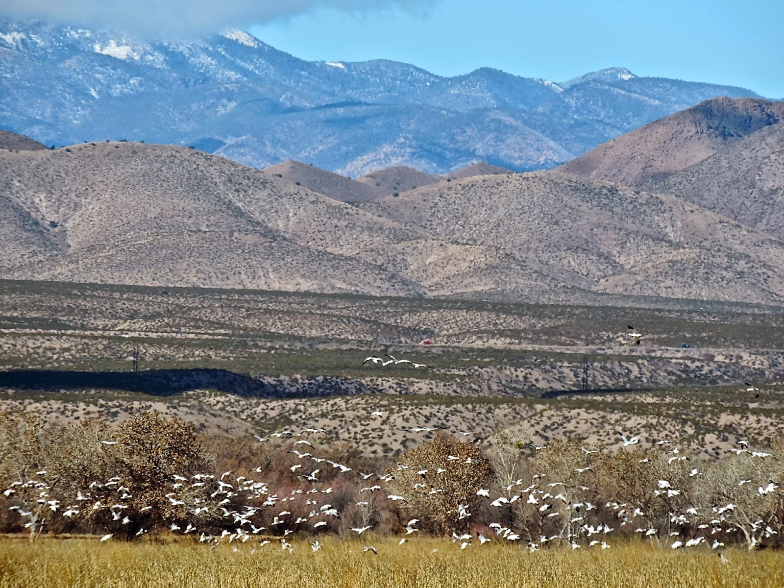
Sandhill Cranes at Bosque del Apache - NM


The "Change Oil" warning had been coming on, so I went from the motel to the Oil and Lube at Walmart next door and had this done. It took nearly two hours and they didn't reset the warning, so I googled how to do that the next day as it kept coming on every time I started the car.

I drove through sunshine, down I25 to busy Las Cruces getting there in mid afternoon and found a Starbucks where I stayed an hour, planning my next few hours. I had intended to stay here but it was too busy, so I headed east on US70, once again totally surprised by the topography. It was late afternoon but still fully sunny as I gained elevation going east and then over the San Augustin Pass of the Organ Mountains to a several-mile descent into a broad flat Tularosa Basin, now already mostly in shadow close to the mountains behind me but with lingering sunset colors flooding the valley ahead of me. I could see for 50 miles as I drove northeast for an hour on a straight flat road, past the White Sands National Monument and through the White Sands Missile Range, arriving in Alamagordo at dusk. The road is temporarily closed during missile firings, once or twice a week for an hour or so. Is this comforting or not?

Another boring Mexican dinner. I wonder if all these little restaurants serve more authentic food...Mexican food...than the Tex-Mex places I'm accustomed to in other parts of the country? Probably...

Snow / Ross's Geese at Bosque del Apache NWR -NM


Tuesday, December 23, 2014

Blue Goose ~ Day 206

December 19, 2014 ~ Socorro, NM to Truth or Consequences, NM

Well, I woke up early this morning in the dark and cold, and the van was literally frozen shut. None of the doors or windows would open and the windshield wipers were also stuck. This is fun.....she said.

But, a small problem really as I just sat for 15 minutes with the car running and everything thawed. It was in the high 20s; I went to McDoanld's until the sun rose at which time I left for Sevillita NWR. I thought it was an hour away but it was only 20 miles, so I got there 30 minutes before it opened. It was 23 degrees there - a higher elevation, I guess and watched the feeder birds. when the VC opened at 8 a.m., I talked with the knowledgeable volunteer, a retiree from the National Park Service. He told me that the Campbell family, after ranching the land for 30 years, gave it to The Nature Conservancy who in turn gave it to the US Fish and Wildlife Service with the stipulation that it be returned to its natural state. Re-introducing Gunnison prairie dogs is one project. The refuge staff also works with scientists at the University of Mexico Long-Term Ecological Research Station adjacent to the VC in a Mexican Grey Wolf Recovery project, breeding and raising them in this remote facility, with minimal human contact, with a goal of a healthy, self-sustaining wild population again.

Sevilleta is one of the largest refuges at 230.000 acres; it has four distinct biomes: Colorado shrub steppe, short grass prairie, Chihuahuan desert and pinyon-juniper woodland, attracting researchers and scientists. It is bisected by Interstate 25 and the Rio Grande. It is not actively managed but rather left alone, allowing natural events (fires and floods for example) to prevail. 

Some hunting is allowed, and there are a few trails and back-country primitive use, but this is not a refuge amenable to the public. I was shown an "auto-tour route" on the refuge map, not well marked, and without the volunteer explaining and pointing out very specific turns and roads, I would have been confused. It basically went down near the Rio Grande into habitat more easily accessed at Bosque del Apache, which also has this river running through it.  There are not public use roads through most of the refuge, unlike Charles Russell in Montana which has a lengthy auto route through its one million plus acres.
Sevilleta NWR - NM

In essence, it's a beautiful wild and remote place with diverse habitat, a refuge in the strict sense as I suspect not many people use it casually. I am interested in exactly what the next-door field station actually does and should have asked. I also would have loved seeing the wolves, even remotely, but again only thought about this later.

It had warmed up some as I drove back to Bosque. I drove the north loop again, watched a couple of Roadtunners, one of which flew up and perched in a tree, saw thousands of geese and cranes and dozens of ducks. The feeders at the VC were more active with eight or nine species, and a pair of Common Ravens sat side by side in a tree in the parking lot, tenderly touching their bills together.
Roadrunner at Bosque del Apache - NM

And then I went back to Truth or Consequences where I mailed Christmas packages, picked up mail and spent time with a friendly FedEx couple who moved here from Rochester, Minnesota, and who how run this "kiosk" Fed Ex and the attached laundromat and live next store.

I worked until after midnight, spending way too much time on a new and particularly difficult dictator, but the reward was a bed with pillows, sheets and a thick comforter type cover.

Blue Goose ~ Day 205

December 18, 2014 ~ Deming, NM to Socorro, NM

The first sign I saw on the highway this morning was for the towns of Nutt and Hatch.

I stopped in Truth or Consequences for gas and completely forgot to get my mail which I realized an hour north. So that meant I would return the following day, and I easily adjusted my itinerary. I was traveling Interstate 25 which runs from El Paso north through New Mexico. Bosque del Apache NWR is an hour north of T or C, a star in the refuge system, one visited by thousands to see the wintering Snow/Ross's Geese and Sandhill Cranes. They host a Crane Festival every February. All photographers love to capture these birds at sunrise or sunset as they lift off in great numbers - in the mornings to forage in nearby fields, returning to roost on the refuge in the evenings. And speaking of photos...There are often photo contests on the refuges and the recent winners at Bosque were displayed. But one of the Honorable Mentions was an odd bird; I had no idea what it was and asked the lady at the desk. She laughed and said, "Well, yes, that's the mystery bird....people have different opinions on what it is..." and she had no definitive answer.  I wondered how it could have been chosen as a winner (of sorts). Here it is:
Honorable Mention Photo at Bosque del Apache NWR - NM

I drove the north loop and did see a nice mix of birds, including a leucistic (white) Sandhill Crane, which has been hanging out here for several weeks.

I had hoped the feeders at the VC would have been more active. I saw a Virginia's Warbler right here in May of 2013 when I had stopped on my way back to Michigan to be with Maria. So this bird is special for a couple of reasons. Of course, May birding is very different from December birding.

I had been in far northern NM earlier on this Blue Goose Adventure but didn't go south enough to check out Sevilleta NWR, north of Bosque del Apache, so I spent the night in Socorro, about halfway between the two refuges. It was dreary and raining and dark by 5 p.m. I found something other than a Mexican restaurant and had a pasta dish, went to the local Walmart, got under all my blankets, read awhile and slept well enough.

Leucistic Sandhill Crane - Bosque del Apache - NM

Blue Goose ~ Day 204


December 17, 2014 ~ Nogales, AZ to Deming, NM

It was spitting rain when I left Nogales, but the skies partially cleared with dramatic clouds alternating with sunshine as I drove north on a lonely but easy road to Cave Creek Canyon in Portal, Arizona. Portal and Paradise are situated on the east side of the Chiricahua Mountains, in one of the most stunning areas of a state that doesn't lack for natural wonders. I passed the Geronimo Surrenders Monument; the Cochise Stronghold (the Apache chief's sanctuary and probable burial place) is on the western side of the Chiricahuas. Everywhere one travels in the US there are reminders of Native American struggles.
Cave Creek Canyon - Chiricahua Mountains - AZ

I didn't go the extra five miles to Paradise but did drive through Portal, not realizing I had done so as the population is 60. Cave Creek Canyon, a few miles up the road, is another birding venue, much like Madera and Ash Canyon. One can stay the night or just pay a suggested $5 and watch birds in the yard. Again, there were 20-30 feeders and nearly constant bird activity against a backdrop of high canyon cliffs. I was the only person there so had my pick of seating and chose the porch as it was chilly, although occasionally the sun came out and the temperature would immediately rise by 10 degrees. Acorn Woodpeckers were numerous, and all the other birds I've been seeing constantly flew in and out including Cardinals which I haven't seen out here that often.
Acorn Woodpecker - Cave Creek Canyon - AZ
Bird and birder densities are greatly increased in spring I am told, especially the hummingbirds. We'll see, early in April, when DHC and I visit again.

The main north-south route reminded me of the Front Range road in Montana, the  road through Choteau and Augusta. Following directions from the Tucson birding book, I found the "Wildlife Pond" out in the middle of a field. It had a bit of water and a gate that was open and askew and a short section of "wall" with openings for viewing birds. Elusive sparrows flew about. The sky was a dynamic display of bright sunlight and clouds moving around in the wind as I drove north through little towns like Rodeo and Road Forks and then east towards Deming where I stayed the night. There were partial rainbows in several places and then a complete arc over the Interstate.


Near Rodeo, AZ
The small towns are pale....partly due to the weathering sun and partly from the light earth that is everywhere. Almost all the yards are fenced, many with chain link, protecting stuff, which often looks like detritus. This can be impressive. Anything bright left outside for long becomes faded. I don't see stray dogs wandering about though. There are many failed businesses in the smaller towns and along the highways, often road-house restaurants or old-style motels, now surrounded by weeds and broken concrete. And always the abandoned houses, some with trees leaning into them, or growing out of them, and often the dwelling itself tilts to the side. The window glass is always missing. They look ghosty and forlorn and intrigue me.

There are usually hills or small mountain ranges on the horizons, often dark masses of rock that rise from the desert, not at all like the Rockies farther north. Sometimes these have trees; often they are bare, accessed by narrow dusty gravel roads with the warnings of "Watch for Water" or "Not Maintained" or "Travel at Your Own Risk" or "Primitive Road." The bigger ranges  like the Chiricahuas, Huachucas or Santa Ritas are forested with conifers and hardwoods, and these have the "birding" canyons.

When possible, ranchers use the land, and roads at right angles to the highways lead to homes barely visible in the distance, usually in a small cluster of trees. I've seen no snakes lately; just snake warnings at parks and refuges. I think they are tucked away during the cold season.

I saw this a couple of times in eastern Arizona...like cracks suddenly appear in the earth? 


Monday, December 22, 2014

Blue Goose ~ Day 203

December 16, 2014 ~ Sierra Vista, AZ to Nogales, AZ

It was cool this morning but the sun was shining as I drove for 15 miles to Ash Canyon where Mary Jo Ballator maintains a casita B and B and a yardful of feeders. I spent an hour in a comfortable chair (there were at least two dozen of these placed advantageously for viewing the birds) with a down jacket and a lap blanket.
Mary Jo's Ash Canyon B and B - AZ
Mary Jo came and sat with me and we spent a delightful half hour talking about her situation and the birds /birders she attracts. She built her straw-bale home, which fortunately survived a devastating man-made fire in 2011, even though the fire roared through her property. She noted that the firefighters dropped slurry on her roof which also helped save it.

A few days previously, she had had a covey of Montezuma Quail move across her yard. She told me they eat tubers and bulbs and are secretive and difficult to attract. But the variety of bird activity, even on this cold breezy day, was impressive, with woodpeckers, thrashers, goldfinches, jays, nuthatches, a tame Bewick's Wren, Anna's Hummingbirds and satisfying views of a Sharp-shinned Hawk as it flew in and perched near the feeders for a couple of minutes. Her immediate yard overlooks a side canyon and a wetland (cienaga) is near enough to attract waterfowl; thus, her yard list is impressive... in the 250-280 range if I am remembering right. She has been doing this a couple of decades, tucked at the end of a rocky road in stunning landscape. Mary Jo is mentioned specifically in the newest edition of the bird-finding guide published by the Tucson Audubon Society. Cookie, her African Gray Parrot kept trying to get her attention from inside, tapping on the window and pleading.... Mary Jo, her parrots and cats coexist here peaceably.  She is a knowledgeable and interesting lady. DHC and I will definitely visit in April....

My next stop was Bisbee, Arizona and what a place that is with a huge, gigantic open pit mine, lovely warm red earth, blue skies...a quaint and quirky place with art and antique and gift stores here in the southern Arizona desert, colorful and striking, surviving on its history and its contemporary status as a tourist destination...a place to buy stuff, which I did (a few things).

I looked through a couple of the emporiums filled in every possible nook and niche with stuff...books,
jewelry, dishes and pottery, old toys, photos, posters, vinyl records, shelves of things like salt and pepper shakers, Day of the Dead memorabilia, old scarfs, clothing, tablecloths, samples of the bright minerals found in the area, gold, silver and copper objects and a thousand other things. 

There was a quartet of troubadours wandering about, dressed in suits and wearing hats over their long hair. The pants of the suits were short and showed their socks. They had a dog or two with them and would stop on the sidewalk and play, then move about in and out of stores, generally wandering up and down the street. The town is like San Francisco in that it is built on a steep hill so there are stairs for people to move between levels.

Bisbee, Arizona
Leaving Bisbee, I went north to Whitewater Draw and was too lazy to get out of the car and walk to the open water where there are high concentrations of waterfowl and Sandhill Cranes. Pathetic, but I've seen ducks and cranes. I was in a wide valley with farms and ranches, wanted to see and figure out grassland sparrows, I so headed slowly south along a wide gravel road back to Nogales, where I stayed in a Best Western, almost on the border. I love when I get a room with a western exposure, which I did here, and can watch the sky at sunset and (here) a thousand lights to the south and west...town lights? or border lights?

Bisbee, Arizona


Thursday, December 18, 2014

Blue Goose ~ Day 201

December 14, 2014 ~ Tucson, AZ to Sierra Vista, AZ

So, the day's plan was Sabino Canyon and Mt. Lemmon, both 15-20 minutes northeast of downtown Tucson. It was a cool and sunny morning, perfect for hiking. Sabino Canyon is a place of spectacular beauty. People were out on the trails, more than any other place I've been - families, old and young, serious walkers and hikers. Words and photographs can show some of this stunning land, but one doesn't feel or smell the desert air, or the sand and rocks underfoot, or the sharpness of the thorns and cactus spines, or hear the sound of Sabino Creek as it spills over the dam and finds a way through the desert.
Sabino Canyon - AZ

I am now reading a book by Craig Childs - The Secret Knowledge of Water - telling of his time walking in the desert, finding water. The author and the desert are intimate. His words are lyrical and tender. born of this love affair. Obviously, the desert seduces certain individuals and they can't stay away; others are willing and occasional visitors captivated by its diversity and beauty; others need to travel through as best they can to get somewhere else; and others die in this need.

Also, I can't get The Devil's Highway (El Camino Del Diablo) out of my mind, the book about the "undocumented entrants" by Urrea.

I now know the names of the ocotillo (which Childs described as "arms reaching for the sky,") saguaro, palo verde, mesquite, creosote, chollo... I know that a tinaja is a pocket of water, that the rough roads near the border are smoothed so "sign cutting" or looking for footprints is easier, that "hoodoos" may roam the desert at night, that humans have been mapping water points for centuries, that the Sonoran Desert is the historic home of the Tohono O'odham, who, of course, have been divested of their aboriginal lands. They live now on four separate reservations: the Tohono O'odham Nation, the Gila River Indian Community, the Ak-Chin Indian Community and the Salt River (Pima Maricopa) Indian Community. Their web site is www.tonation-nsn.gov.

There is a road to the summit of Mt. Lemmon, but I only drove part of the way, stopping several times to look and listen for birds as I climbed higher and the habitat changed, and to savor the immediate surroundings without having to keep an eye on the road, which, although precipitous, is easy to drive, with guardrails and pullouts. At one stop, I head a tremendous thundering boom, followed for the next 15 minutes by regular, more distant explosions or whatever they were. I still don't know. The first one startled me enough so I jumped; the others were farther away.
Kestrel on saguaro - Sabino Canyon - AZ

The temperature dropped as I climbed. It had been in the 20s at the top this morning. If we have time, DHC and I can go to Summerhaven, the small village up there on privately owned land. The rest of the mountain is part of the Coronado National Forest. Bicyclists were slowly and methodically pedaling up the mountain and others were coasting down with speed and concentration. It's 27 miles to Summerhaven and the temperature is 30 degrees cooler than in Tucson, making it very popular in the summer.

Modern Tucson or old Tohono O'odham.... lycra or clay.....

I spent the night in a motel in Sierra Vista, 100 miles southwest of Tucson, in the broad San Pedro River Valley between the Huachuca and Chiricahua mountains. I stayed at the Windemere Hotel and was checked in by the most friendly and pleasant person I have encountered on this trip at a motel reception desk. Her name was Regina. She asked questions about why I stopped in Sierra Vista, listened to the answers and printed out information on local birding areas which she slipped under my door within the hour. While the accommodations were not extraordinary, she was the reason I elected to stay a second night. I also had a day's worth of housekeeping and paperwork to tend to, AND this is one of the best areas for birds in Arizona.

Dinner at an Applebee's across the street, along with stops at Best Buy, where I checked whether Canon cameras were on sale for Christmas, and Wells Fargo where I deposited a check.

Sabino Canyon - AZ


Tuesday, December 16, 2014

Blue Goose ~ Day 200

December 13, 2014 ~ Patagonia, AZ to Tucson, AZ

I don't know exactly why I went back to Tucson, but it had something to do with the weather. Rain was in the forecast, and at first I thought it might clear, but it didn't and started raining intermittently at first and then harder as the day progressed.

Initially, I headed for what Larry at the Paton house called the "grasslands" and which should be good for sparrows. I checked out of the hotel, had another delicious breakfast at the coffee house, looked at the maps and starting driving, generally south of town, but soon was on gravel roads with warnings about being close to the border and primitive roads that weren't maintained and to travel at your own risk, and I wasn't quite certain where I was. I came to an intersection with arrows and signs and road numbers not exactly making sense according to my maps. And, in fact, I was off a bit when I finally realized where I was. I was supposed to look for a horse tank, etc., but after 45 minutes of slow gravel-driving in the rattling van, I came out at a high point, probably only a few miles from the border and turned back.

Near San Rafael Valley, south of Patagonia - AZ
Besides, it was not good birding weather as it was chilly, breezy and starting to rain more than it didn't.

So I pondered where to go next and thought how I hadn't checked out some important Tucson venues and that there was WiFi available at the Starbucks near the Walmart where I stayed before heading south and how Tucson really wasn't that far. So I went back, now driving in significant rain, but by the time I got to Interstate 10, the rain abated. I took a route around the south and west of Tucson, stopping again at the Arizona Sonora Museum and again going through Saguaro National Park. The rain made the air sweet and delicious. The lady at the museum ticket office told me it was the creosote. This place is stunning, and with far fewer people (being the end of a rainy day) and a clearing sky, I was glad I returned, even though now I regretted not having more time.
Sonoran Desert - west of Tucson - AZ

When I got into town, I ate at Starbucks and worked on the computer until 9:30 p.m.

It was going to be sunny in the morning.

Blue Goose ~ Day 199

December 12, 2014 ~ Patagonia Lake State Park, AZ to Patagonia, AZ

I left the campground early and had breakfast and coffee at Gathering Grounds before going to The Nature Conservancy land where I hiked a couple of miles. What I didn't know but learned from a couple of women I met on the trail was that a rare Rufous-backed Robin has been seen here lately. I had passed a guy when I started walking who was looking through his binoculars. I continued on without speaking, but ran into his parents who said he doesn't like to hike with them because he wants perfect silence, no talking, gets impatient if there is any noise. Jeez, I was glad I didn't say a word to him. He lives in Denver but was visiting his parents who live down here in Sierra Vista.

One trail option was an old raised railroad bed, the tracks dismantled, so one was 8-10 feet above the surrounding land. The cottonwoods were immense, old and weathered and gnarled with thick roots half exposed, spreading far from the main trunk. I keep reading about the Fremont cottonwood / Goodding's willow habitat in the lower elevations, along the creeks and in the cienagas. There was actual running water in Sonoita Creek here and at Patagonia Lake instead of a dry wash.
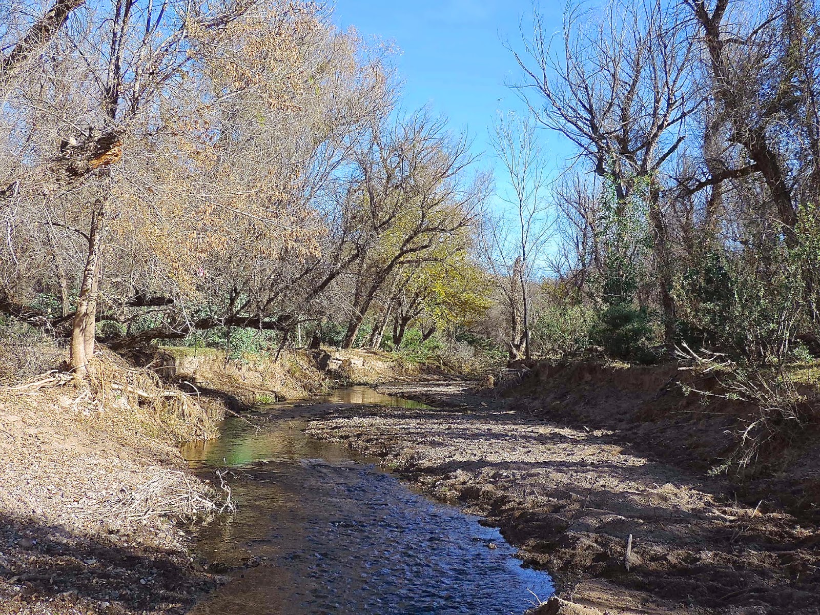
Sonoita Creek - near Patagonia - AZ


Later I saw the unsocial birder coming towards me, and he asked if I'd seen "the robin." I told him, "No, it's what I'm looking for..." like this was my mission from the get-go. He was leaving and said if I found it, let out a "loud bird call.....just kidding..." I did wait quietly, willing this bird to show. It didn't.

The volunteer couple at the small Visitor Center told me they will be here for several months and then go back to Lassen Volcanic National Park in northern California, where they've worked before, and are also scheduled to go to Martha's Vineyard next year. They love doing this, are currently living in a small RV on The Conservancy property and are always busy. No, they said, it doesn't get boring ever.

And then one more trip to the Paton yard where a multigenerational family group from Minnesota was hanging out. An older woman had been here a couple of time before but over 20 years ago. Birds:  a Lincoln's Sparrow, Bewick's Wren, a Green-tailed Towhee... Cardinals and Pyrrhuloxias side by side for comparison, the Lazuli Buntings, Lesser Goldfinches, Gila, Ladder-backed and Acorn Woodpeckers, Red-naped Sapsucker...all good.

I had made a reservation at the hotel in order to work so checked in about 3 p.m. It had some charming features in that it was old but refurbished, with a real log fire in the lobby fireplace, Christmas greenery running up the bannister, a decorated tree, an upstairs lounge with living plants,  and games and puzzles, several shelves of books, tables and a couch and comfortable chairs, a computer and printer. One walked up an indoor staircase to access a balcony with the rooms surrounding a pool. It was too chilly to use today, but there was also an outdoor second-floor covered patio with comfortable chairs. The rooms were adequate, and the Internet connection not problematic.

I had the intention of eating at the Stage and Stop (connected to the hotel) which would be decorated nicely for Christmas with low lights, and locals and fellow travelers eating out on Friday night. The food would be exceptional, the wine chilled and the ambient temperature perfect. There would be classy music. It would be festive and relaxing. That was the plan.

The reality was that I was the only person in a bright dining room which was clean but not cozy or even comfortable; the food was priced twice what it should have been and wasn't exceptional in any way. A sweet young girl (is there a legal age for kids to work in this state? as she looked about 12 or 13) took my order. The BLT with avocado on ciabatta was on whole wheat. The tortilla soup was dense. I think this was a family project and the kids were hanging out where their mom worked. There was a cute little toddler also present for awhile. I don't know if or how they were related to the proprietor of the hotel or what exactly. I just regretted eating there. How do these places stay open if no one comes in? Jerry of the hotel did say they were just starting to serve dinner. There isn't much choice in Patagonia.

Oh well....I have had three extraordinary meals on this trip so far.
American Coot - Patagonia Lake SP - AZ


Blue Goose ~ Day 198


December 11, 2014 ~ Patagonia Lake Campground, AZ

I woke before dawn, read some more and took a shower at first light. The bathroom was pristine and heated.

Connie and Joe had a plane to catch and packed up right after breakfast. Connie was always looking in the trees with her binocs and spotted a brilliant Vermilion Flycatcher high on a nearby exposed branch, a great start to this chilly, sunny morning.
Vermilion Flycatcher - Patagonia Lake SP - AZ
She told me that one of their daughters lives in the Florida Panhandle and gave me her email address...someone to go birding with once I get there. I would love to have Maggie connect with them somehow, and maybe Livy, Camille and Louise could spend a session at the camp...and Donovan if he wanted. Maggie could work there...spinning this out. They gave me an open invitation to visit... "We have a wonderful chef!" What a life for these two. It was a pleasure to meet them.

I hiked back along Sonoita Creek, and hung around the trogon area for 40 minutes but saw only a few birds and not the ET. Pete Dunne describes it thusly: "The adult male looks like a bird painted by a color-struck four-year-old." He writes of the bird sitting immobile for a long time and then it "suddenly goes berserk, throwing itself against the foliage in a fluttering frenzy of wings and a fanned tail, grabs a large insect (or plucks a fruit) and takes a perch, once again composed." The trogon is large and colorful and elusive, a perfect nemesis bird.

I told the ranger I would be staying a second night and returned to Patagonia, got a few groceries, had coffee, poked through a few of the small galleries and went again to the Paton yard, before returning to the campground to read in the sun mid afternoon.

I was on the bridge early enough to watch the birds as the sun began to set: Great Blue Herons, Coots, a Marsh Wren working through the reeds and the Black-crowned Night-Herons flying in.
Great Blue Heron - Patagonia Lake SP - AZ
A gentleman came up, also to watch. He was from Maine and was traveling with his 92-year-old Dad, visiting historical spots in the Southwest, just back from the Grand Canyon. He was my age and had to soon fly back to Maine, but his Dad was continuing the road trip...his 92-year-old Dad would be driving around in the RV by himself. Yes, he did worry a bit, but what can you do? He had binoculars and a worn bird guide in his pocket. More and more I can speak the language with other birders, or even help some of them....They too had been trogon-seeking today but didn't see it either.

Earlier in the afternoon, when I got back to my campsite, there was a mid-size RV parked very close. A gentleman was trying to get it positioned perfectly, slowly backing up an inch or two, getting out and checking it, moving forward, backing up.... They were German, Reiner and Katherine. I asked him to spell his name before I could understand him. He said, "This is not a good system.." but I had no idea if he meant we were too close to each other or what exactly. They never left the RV as far as I could tell and covered their windshield and I covered my side windows as I could see him sitting by a small high window, reading (or maybe watching TV), very near the van.  I would have liked to talk with them, to hear their traveling tales.

Patagonia Lake State Park - AZ