Monday, June 13, 2016

Destination Circle: Day 29

June 11, 2016

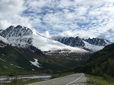
along route 99 in British Columbia
Fraser River along route 97 in British Columbia
It was time to look at the maps. I am headed to Oregon, which is southwest, and had only a couple of options. It was an easy choice as I am so averse to traffic. There was a large sign at the junction: "Route 99 or 97 to the Coast - Your Choice," and spent the next three hours going through the mountains on winding roads, gearing down constantly, going over occasional one-lane wooden bridges and stopping a few times to absorb the scenery which was difficult to do while driving without dropping off the mountain. It was grandiose, stunning, awesome.

I have been reading the book Klondike, and much of the route I've been following is one of the options the stampeders (those seeking gold) used and is part of the Gold Rush Trail. Incidentally, the book is fascinating, concentrating on the rush through Skagway to the Klondike River at Dawson City where it joins the Yukon, but the author also touches on the other routes, like this one through BC. There are towns on the main north-south highway (97) that today are named 100 Mile House or 70 Mile house or 150 Mile House, harkening back to the way stations along the gold trail. It was in one of these towns, I actually saw a RCMP driving a white SUV and totally fitted out with black, high-tech police gear, offensive and defensive. 

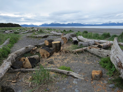
log jam on one of the rivers along route 99 in BC
I have seen barely any obvious police presence on the roads which is remarkable. The speed limits are generally obeyed, and there are signs telling travelers to "Use Your Road Sense." 

Of course, speed limits are metric, but one gets used to this quickly. I think the loonies and toonies ($1 and $2) coins) are so cool.

My destination was the Fairmount Chateau Whistler, the upscale ski resort north of Vancouver, again because of a Priceline deal. In retrospect, I would not choose this again. As I drove in, I immediately saw a sign indicating the parking options: $35 for self parking; $39 for valet service, and the restaurant / bar prices also reflected what the wealthy will pay.  I much preferred the hotel where I stayed at Lake Louise, almost in the shadow of another Fairmount Chateau, but less pretentious. 

The psychosocial dynamic in these places is interesting as the staff are ALL extremely pleasant, verging on obsequious, young with English, Asian, Germanic or Scandinavian accents; most girls are blond; the handsome, efficient valet staff looked like Prince Harry and his friends; the check-in staff a bit older and very deft at dealing with all who wander into this place...some with young kids and well-mannered dogs, different nationalities, many clientele obviously used to deferential treatment. But, there is a steeliness and the expectation that everyone behave and pay up and be grateful they are allowed to stay here...or something like that. I thought it a bit odd to see adult men wandering about in the plush white terrycloth robes from the rooms, on the way to spas or pools or who knows where. 

Royal Canadian Mounted Police vehicle
Women with shopping bags, of course, as there were numerous opportunities for this activity. Even with all the money in the world, it seemed excessive to me. I'm sure it's the same scene at Aspen or Vail, Park City or Sun Valley, etc. 

Destination Circle: Day 28

June 10, 2016

Chetwynd, British Columbia - 3rd place in a previous year's competition
Chetwynd Chainsaw Competition
watching the artists...
While not raining, it was still gloomy when I woke and wandered through the chainsaw competition. The 12 participants were under white tents, working carefully on huge blocks of wood, while helpers shoveled up the sawdust. Most contestants wore safety gear and ear plugs, but not all of them. It was quite a spectacle, especially after seeing the results from previous years all over town. An impassive First Nation gentleman sat on the bleachers watching while most people milled about.

typical rest stop scene - northern BC


Leaving Chetwynd, I drove several hours under cloudy skies to Quesnel (Kwa'nel) as the highway became busier and busier. Shortly after arriving, the sun came out, and an hour later the rain started although the sun kept shining, making the raindrops and puddles silvery.

Best Western has a nice promotion going, so I stayed at one in a wonderful sunny room looking west, ate a pretty awful stir-fry in the hotel dining room and cursed the almost nonexistent Internet connection.

My northern idyll of few people and cars, of daily bear and moose sightings was ending. But there were still incredible, rugged, snow-covered mountains and wild, white-water glacial streams, the grand Canadian rivers, small glassy lakes, marshes and trees, trees, trees....

Sunday, June 12, 2016

Destination Circle: Day 27

June 9, 2016

dead spruce trees south of Fort Nelson, BC
At Fort Nelson I turned south and slowly, throughout the day, re-entered civilization - telephone poles, traffic, commerce, all of which was depressing, especially as the skies were gloomy and it was raining. My plan was to go to Mile 0 of the Alaska Highway since I would then have driven the entire route. It begins at the eastern edge of British Columbia in Dawson Creek. I did stop once along the way at Sasquatch Crossing for a cup of coffee, a banana and two regular postcards, and the guy at the cash register said, "$15.25." I choked and he explained "postcards are $4 a piece" whereupon I put them back, and in this complicated math transaction, my total dropped to $4.88.

Black Bear along Highway 97 south of Fort Nelson, BC
The road south from Fort Nelson was still through wilderness for a couple of hours, but the Rockies were now out of sight to the west and the landscape began to change to more deciduous trees and open ranch- and farm land. I did see one large Black Bear munching at the edge of the spruce while still relatively far north, but that was the only "megafauna" of the day.

I walked into a Visitor Center 30 miles west of Dawson Creek where I was accosted by a middle-aged East Indian lady working there and trying her best to be the most helpful volunteer on the continent:

"OK, so you're traveling south to Dawson Creek, to get to Mile 0. I understand why you want to do that...OK, so that's not the most scenic route but I know you want Mile 0. Would you like some coffee? The restrooms are over there and here's the key. Where are you staying tonight? Well, when you get to Quesnel, you should stay at the Fraser Inn. I'm not supposed to tell anyone this, but I always stay at the Fraser Inn on the Fraser River. I'm really not supposed to tell you that. You can use hotwire.com. Here I'll write it down for you....(Me: Thanks, but I know about hotwire; you don't have to do that...) Do you want any coffee? I'll get a map and show you where it is. (Me: that's OK; I have a map). If you need to use the restroom before you go, the key is on the little hook over there. Here's the map and I'll show you the route. And here, I wrote down HOTWIRE.COM for you. So tonight, you will stay in Chetwynd? Good; you better make a reservation because the chainsaw carving competition is going on this weekend. You can use hotwire.com to do this. Here is some coffee if you want...."

As I moseyed about, checking out all the pamphlets and brochures, she began talking with a young Italian couple about the Dempster Highway so I perked up and then asked them if they were going to drive it. They said they only had a regular car and were going to see if they COULD, but otherwise they might fly there from Fairbanks or Dawson City. (The Dempster is the 450-mile unpaved highway north to Inuvik from Dawson City.

dempsterhighway.com

The Dempster Highway is a 740 KM (460 miles) hard packed, but well maintained, gravel road that winds its way through two mountain ranges, the Oglivie and the Richardson; crosses the continental divide three times, traverses the Arctic Circle and loosely follows the old dog team routes on its way to Inuvik and the Mackenzie Delta where access to the Arctic Ocean is available.

I did make it to Dawson Creek and immediately, without stopping to take even one photo, I went. I hope there is more charm to this town than I saw in the gloom and rain. I expected a totally different venue and make in the sunlight and off the main highway, there is more than the dreary business section I saw. I was driving a wedge-shaped route here, coming into town from the northwest, arriving at the point of the wedge and then turning sharply to head southwest, kind of retracing my route for about 40 miles. But I could now legitimately wear a hat or T-shirt "I Survived the Alaska Highway." 

I spent the night in Chetwynd, ate schnitzel at a newly opened restaurant owned by a Chinese couple, and spent 30 minutes trying to find a Priceline motel, going in circles following the directions of a harried Siri and finally asking someone. The motel was spartan in a modern way, new, but not cosy. 

Everywhere in this small town (which used to be known at Grande Prairie) were chainsaw sculptures. This competition began in 2005. It vies with the Husky Cup in Germany for the world's best carving contest. This year there are 12 entrants. They are allowed 36 hours to carve and start with huge pieces of cedar, but of different shapes, and drawn by lottery. So the artists have to be prepared to adjust what they will carve according to the size and shape of the block of wood they get. 

Chain saw carving in Chetwynd, BC
Their work is amazing. I have only ever seen the rough chainsaw carved bears, etc. These are nothing like those...

Saturday, June 11, 2016

Destination Circle: Day 26

June 8, 2016

I woke early, before 5 a.m. Of course the sun was up but I was in the shade from Germany next to me. It was 36 degrees, I was still warm in my sleeping bag. Before anything, I always get my phone and warm it up when the mornings are this cold, and then I walked to the bathroom...a welcome 70+ degree bathroom, painted bright blue, clean, with very loud 50s music: Elvis, Fats Domino, Nina Simone, B. B. King, Dinah Washington... Here in northern Yukon, 5:15 on a June morning, in a campground bathroom...a concert from my teenage years.

Mist was rising from the lake in bright sunlight; a man was walking two beautiful dogs; another guy in a short-sleeved shirt meandered about with a coffee cup in hand. I love the stillness and peace of this northern country.

By 5:45, I was at Tags, getting gas and waiting for the "restaurant" to open. A gentleman was working who may or may not have slept after the bars closed last night. He definitely had not had a life of ease, and when I asked if he was open, he gruffly said, "Can't hear ya.." But his demeanor slowly mellowed as I let him know his eggs and bacon were delicious and didn't try to engage in chit chat. Truck drivers who had slept in their rigs overnight wandered in.

There is a dessert bar called Nanaimo Bars - a "classic Canadian dessert" and which I used to make. (I think the recipe is in the Dutch cookbook.) The store had these for sale - a package of four - which I couldn't resist. Does anyone else remember them?

en.wikipedia.org:

"It's a bar dessert which requires no baking and is named after the west coast city of NanaimoBritish Columbia. It consists of a wafer crumb-based layer topped by a layer of custard flavoured butter icing which is covered with melted chocolate made from chocolate squares." 

Fox just east of Watson Lake, BC
I left Watson Lake at 7 and the sun was high enough to not be bothersome. For the first hour, almost no one was on the road, except three foxes, one carrying something large and rounded in its mouth, but I couldn't get the right angle to see what it was. My imagination suggested a human skull which I am certain it wasn't, but it was a weird shape. Within the next few hours, I saw four bison, six black bears, one moose and eight sheep along the highway. And somewhere in this stretch, I passed a Golden Eagle standing on top of a dead moose, its posture suggesting pride of ownership. 

Wood (or Mountain) Bison - northern British Columbia
At the overlook near stunning Muncho Lake, I talked briefly with a guy who hauls between Edmonton and Whitehorse and who told me about the fish in these waters and how one of these trips he wants to "take the wife" along. Fish in the range of 40-pound trout... I cannot imagine doing this route (945 miles) over and over, especially with a loaded 18-wheeler. He says he leaves "Saturday night about 6...I'm supposed to get into Whitehorse by Monday night, but I'm always there by noon....then I unload and take my time coming back empty." The highway is not always a piece of cake as it goes through the mountains, with many areas of loose gravel / construction, rough roads, narrow roads, winding roads. It's totally doable and relatively easy but I wouldn't want to have time constraints, especially once the temperature drops and the snow begins. 

Black Bears in northern BC

Non-paved but public roads: There is the all-season, 450-mile gravel Dempster Highway in Canada going north from Dawson City to Inuvik in the Northwest Territories or the Dalton Highway (adjacent to the oil pipeline and also 400+ miles) running north of Fairbanks to Deadhorse and Prudhoe Bay... I would LOVE to travel these...

I stopped mid afternoon in Fort Nelson and spent time in the Visitor Center, browsing but not buying, getting free information and chatting with a lady as we tried to identify a very common purple roadside flower I have been seeing for days.

Stone sheep near Muncho Lake - northern BC
A distressed gentleman and his wife from Michigan were venting about their device challenges and how they "haven't called home in days" as they couldn't connect, and how frustrating it has been trying to use a Discover credit card. I found this out also. The deal is that apparently Discover charges businesses too much AND doesn't "pay for 10 days" while with VISA "I get my money immediately." The VC folks nodded and told of a recent woman traveler who was "in tears" as she encountered these problems, adding also that they wouldn''t take her American money. So it goes...

I stayed in motel with windows overlooking a small collection of trailers. Late afternoon, a little girl anther younger brother rode a kids' four-wheeler bike round and round the gravel lot for an hour. They so reminded me of Tesla and Joey (Ginny's kids). 

Fort Nelson I read somewhere is an "oil and gas town" and it did seem like a much smaller version of Williston, ND. I think most of the motel's clientele were gas field workers, although in the summer, tourists also contribute in a significant way to the area's economy.

I also read that the town's current location is the fifth site due to "fire, floods and  feuds." Every place has its history. 

Muncho Lake - northern British Columbia


Friday, June 10, 2016

Destination Circle: Day 25

June 7, 2016

Commercial tour bus on outskirts of Whitehorse on the Alaska Highway
The morning was overcast so lingering over coffee was the plan. Whitehorse has two Starbucks. Quelle surprise!  While I was reading and drinking coffee, a young girl with Down Syndrome started her shift. She put on the green apron and was walking around holding the ties when another employee, an Asian girl, came up to her and gently took the ties, turned her around and tied the apron. It was a sweet gesture.

I had oil on my mind. In Dawson City, when I asked for a recommendation on where to get this done, I was advised it might be best to "wait until Whitehorse if you can." So I presume people in these smaller towns in the north take care of car maintenance on their own because surely they don't drive several hundred miles for an oil change.

I first walked in the Auto Service area in Walmart. Two guys were working with their backs turned toward me but it was noisy and after waiting 60 seconds with no acknowledgement, I left and went to EnviroLube where I drove right in. The place was spotless, and while two guys and a girl attended to checking and changing and topping off fluids, a third guy spent the whole time trying to get the bugs off my windshield. For these services, they charged $172.00! I was shocked and berated myself for not asking up front what it would cost but also was relieved I didn't have any issues, as nearly every time I took the Subaru in for routine maintenance the past year, something was wrong: brakes, rotors, head gasket, catalytic converter, heater issues, malfunctioning door-open light, total loss of navigation system. It was like waiting in a doctor's office for dire news.

Quaking Aspen leaves: healthy and leaf miner at work
Yukon Arts Centre - Whitehorse YT
Boreal Chickadees have also been on my mind lately, so I researched eBird and went to the campus of the Yukon Arts Centre and walked around for an hour, peering into the conifers and listening for this northern chickadee with no success. It's not uncommon up here, but birds have nesting and parenting going on so aren't as active and vocal as other times of the year. While poking around, I crossed the TransCanada Trail, passed a young mom pushing a baby stroller with one hand and holding bear spray in the other, and admired the outdoor sculptures. The Centre is situated in a pretty spot on a hill overlooking the town.


Before I left Whitehorse, I also went to a museum on the eastern edge of town dedicated to Beringia:

thecanadianencyclopedia.ca

"Beringia is a landmass including portions of 3 modern nations (Canada, US and Russia) and extending from the Siberian Kolyma River and Kamchatka Peninsula, through Alaska and Yukon Territory, to the Mackenzie River in the Northwest Territories. Near the centre of the region is Bering Strait, for which it was named. Today, this strait links the Arctic and Pacific oceans, but in the past lowered sea levels, resulting in part from growth of continental glaciers, exposed portions of the continental shelves to form a broad land bridge between northeast Asia and northwest North America.

The importance of Beringia is twofold: it provided a pathway for intercontinental exchanges of plants and animals during glacial periods and for interoceanic exchanges during interglacials; it has been a centre of evolution and has supported apparently unique plant and animal communities. The history of Beringia is important not only in the evolution of landscapes but also in that of plants and animals."
Yukon Beringia Interpretative Centre - Whitehorse, YT 

All afternoon I drove east and the sun came out late in the day. Just west of Watson Lake, I drove five miles back into the equivalent of a state forest campground and went around one of the camping loops twice but didn't stay. It was dark and lonely with few other campers and minimal facilities. And too early to just go to sleep. So instead of paying $12, I paid $35 at a city campground in Watson Lake. "We don't allow tents," said the campground manager, a robust man with an Australian accent. "People leave food out and it attracts the animals....There's an electrical outlet if you want to charge your devices. You're near the bathrooms." He put me in a spot between an RV from Germany and a sedan pulling a small camper from Florida with a bumper sticker telling people that Trump will Make America Great Again. I didn't see or talk with either of my neighbors. The RV from Germany was spotless, their shades were drawn, and it appeared, from the decals on the side, that these travelers were going around the world. A lake across the road had a Nature Trail with signs and information about dragon- and damselflies for which the area is known.

I ate at Tags, a gas station / truck stop that also featured free condoms in the rest room. I had minestrone soup (so-so) and a good BLT wrap, freshly made. The dining area was the epitome of utilitarian, with no charm whatsoever...a painted concrete floor and fluorescent lights in a large space adjacent to an open kitchen. But it was clean. The attached well-stocked grocery store was impressive with all items perfectly arranged on shelves, a good selection of fresh fruits and vegetables and the expected miscellany of road travel, non-food items. One just never knows when expectations will be exceeded, and most of this trip mine have been. 

Like the Sign Post Forest across from Tags. Incredible! Currently, there are 77,000 signs from places all over the world. While it seems tacky, somehow it wasn't...
Sign Post Forest - Watson Lake, YT


Thursday, June 9, 2016

Destination Circle: Day 24

June 6, 2016
Dawson City (not where I stayed though)

The breakfast at the B and B was upstairs in the family's living quarters and was cooked to order: pancakes, omelets, eggs, sausage, bacon, or muffins and cold cereal. At first I was the only person so was the object of attention of a precocious, cute 7-year-old who showed me her Pokemon cards and drawings and colored erasers. Her mother gently tried to tone this down and I wondered about their lives, with total strangers wandering in and out every morning all summer. The room was appealing to me: elevated so it overlooked the neighborhood, full of windows, a kitchen, a sitting area with comfortable chairs and couches, two blond wood dining tables, bookshelves....

Another couple came up the stairs. I thought they were Australian but they were, in fact, from Britain. However, in the course of the conversation (mostly between the man and me), I learned he had worked in New Zealand and also in the US for 11 years. What did he do there? and where in the States did he live? Well, in Nevada and then he moved north through Utah, Wyoming, Colorado, Montana as he sheared sheep for a living. Sheep-shearing...probably last on a list of possible professions if I'd had to guess. They now travel; his wife prefers "caravanning" in Europe as she has only been seeing "trees" in Canada. She did lighten up when they talked of a three-day visit to Las Vegas. They had no definite itinerary this trip except for having to be back in Calgary on a certain date to fly home. Gravel roads didn't bother him a whit, and they were going west on Top of the World, or visit gold mines in the area, or take a Yukon steamboat if at least 15 other passengers signed up. Loose travel plans. He did mention Watson Lake: "We were there; there's nothing there." But there WAS something there as I discovered.

Part of Jack London's cabin, now in Dawson City, YT
We talked politics a bit and he allowed how "we are all struggling" with the Trump phenomenon, meaning both parties in England. He said this carefully at first, not wanting to offend me. "Struggling" came out as "strooggling." As for Canada's leader, the owner admitted to "not liking him very much" and the Britain said he was just a "pretty boy, and he's been naughty lately hasn't he?" It is interesting to get the perspectives of foreigners, and humbling as they often are sketchy about all that we take for granted in the US. They just are not all that into us, certainly not like we are into ourselves.....I said the US acts like the British when they were an empire in that we think we are superior and know what is best for the rest of the world. Very simplistic, I know, but... And we Americans are definitely just not into the rest of the world.

It rained all day, off and on, but often the showers lasted 10 seconds. The first raindrops left tiny silver paw prints on my dry windshield. As I drove out of town, I was horrified at the mess after mining the creeks - huge piles of stones everywhere. Dawson City is protected from the Yukon by a small levee (dike)  built after a flood in 1979, one of many throughout the years.
the sequelae of gold mining - just south of Dawson City, YT

The Klondike Highway runs south to Whitehorse for over 300 miles, and I drove all day in the gloom and rain, seeing only an occasional vehicle, on a road that had no shoulder for much of the way. Like if one had a flat tire or other breakdown, I have no idea what they would do since getting off the road seemed impossible in many places as the surface dropped two to three feet at a sharp angle - a tip-over angle in my estimation. There were no radio stations available but I didn't mind the long day driving through spruce and aspens and poplar forests, over mountains and through muskeg, across rivers and creeks. The highway leaves the Yukon Valley for the first couple of hours and then meets up again. At a pull-off high above the river, I could see Five Finger Rapids. Each year there is a Yukon River Quest from Whitehorse to Dawson. Canoers and kayakers compete in a race that takes 50 to 60 hours and is 444 miles. This year will be the first time SUPer's are allowed - SUP meaning stand-uppers as in paddle-boarding. Are you kidding? Paddling standing up on this river for that long? But these people are tough.
Five Finger Rapids on the Yukon halfway between Dawson City and Whitehorse

The sun finally came out as I approached Whitehorse where I stayed for the night and where the north-south Klondike Highway intersects the east-west Alaska Highway, which is also known as the "Road of '42." It was built by the US in response to the threat from the Japanese in WWII, and to connect the "contiguous US through Canada."

en.wikipedia.org:

"When the United States approached Canada again in February 1936, the Canadian government refused to commit to spending money on a road connecting the United States. The Canadians also worried about the military implications, fearing that in a war between Japan and North America, the United States would use the road to prevent Canadian neutrality. During a June 1936 visit to Canada, President Franklin D. Roosevelt told Prime Minister W. L. M. King that a highway to Alaska through Canada could be important in quickly reinforcing the American territory during a foreign crisis. Roosevelt became the first American to publicly discuss the military benefits of a highway in an August speech in Chautauqua, New York. He again mentioned the idea during King's visit to Washington in March 1937, suggesting that a $30 million highway would be helpful as part of a larger defense against Japan that included, the Americans hoped, a larger Canadian military presence on the Pacific coast. Roosevelt remained a supporter of the highway, telling Cordell Hull in August 1937 that he wanted a road built as soon as possible.[4]
The attack on Pearl Harbor and beginning of the Pacific Theater in World War II, coupled with Japanese threats to the west coast of North America and the Aleutian Islands, changed the priorities for both nations. On February 6, 1942 the construction of the Alaska Highway was approved by the United States Army and the project received the authorization from the U.S. Congress and Roosevelt to proceed five days later. Canada agreed to allow construction as long as the United States bore the full cost, and that the road and other facilities in Canada be turned over to Canadian authority after the war ended." 

It's the only road INTO Alaska other than the Top of the World Highway. Traveling in May is a good choice as traffic was much less and rates were generally more reasonable than later in the season. Most facilities were open, although many only re-open mid May. 

Tomorrow, I WILL get the oil changed in my car....


Wednesday, June 8, 2016

Destination Circle: Day 23

June 5, 2016

A lovely sunny morning and not even chilly. I went back to Fast Eddy's for coffee but then settled in for breakfast to have an omelet with reindeer sausage. It was yummy. The hash browns that came with it would have served a family. It was busy and bustling this Sunday morning.

Post office in Chicken, Alaska
And then on to Chicken, Alaska. First I drove east from Tok (pronounced Toke) on the Alaska (Alcan) Highway for a dozen miles and then north for 60 through rolling open land with lots of black spruce. The last dozen miles were gravelly. Chicken was supposed to be named Ptarmigan but there was disagreement amongst its founders on how to spell that, so Chicken it became. The post office is tiny and across the street from a log cabin in which a mandatory mining class was in progress. A gentleman told me that if miners didn't comply with the regulations of keeping up-to-date on mining issues and attend periodic day-long sessions, they would be penalized and have to take a two-week course.

music fest stage in Chicken Alaska
Chicken was settled by gold miners. There is still active mining, which, along with the interest and curiosity of tourists who have a sense of adventure and visit and spend money, is the raison d'être of Chicken today. A well-stocked general store offers tourists camping space, free firewood, hundreds of gift items, espresso, baked goods and food. It was easy to spend time moseying and browsing here. The chicken theme and chicken sculptures are everywhere in the village. If I were ever to return to Chicken, I would spend a night camping here as it was so pleasant, laid back, tucked in the hills. The whole area around the store had been freshly raked; there was a generous deck in the sunshine for hanging out, and the coffee was delicious. It was kind of funky, a lot like Homer. The chick running the place was "born and raised" in Chicken which is kind of difficult to imagine. There can't be too many people who can make that claim. She was attractive, efficient and helpful, answering all queries coming her way.

A typical Alaskan tourist couple (white and middle-aged with a large RV and small dog) came in and the gentleman was harried. He had just driven the Top of the World highway FROM Dawson and asked, "How's the road from here to Tok? Jeez, we need to catch our breath....the road we were just on had no guard rails...it went straight down 1000 feet. Jeez...we may just stay here a few days. Does the road get better? We didn't know it was going to be so steep with drop-offs...."

"Oh, yeah," said the lady at the counter, "that's the goat trail...." (whatever that meant). She assured the man and his wife that there wasn't much more gravel on the road down to Tok; he was definitely relieved, but still wanted to stay put for at least one night....maybe two. Whew.....

Hmmm....this was the road I was about to take. Before I left, I told her about the road between Durango and Ouray in Colorado and how "scary" I found that. She apparently knew what I was talking about and said I wouldn't have any problem.

Top of the World Highway - Chicken to Daswon
Maria's tower on Top of the World Highway
Off I went for several hours, to Dawson, past a few mining operations which pretty much rape the stream beds, into the mountains with significant drop-offs but nothing I haven't seen before, through customs in a lonely wind-blown outpost apparently to the satisfaction of a handsome black-haired agent, and then drove a couple more hours on top of the world. It did seem like that; it was gorgeous. The Canadian side was packed gravel and dirt and actually quite easy to drive with incredible vistas in all directions. At one pullout, there was a little tower of flat stones that I silently dedicated to Maria. If the stones are placed to represent a human figure, they are an inukshuk, but I usually see just a little tower of 10 - 12 stones here and there along the highways in places where the rocks are flat enough to stack. Those really aren't inuksuit (plural of inukshuk) but I like them, and they always remind of her.

approaching the Yukon River from Top of the World
Slowly the skies clouded to the point where, near Dawson, it began drizzling and then raining, making the road surface slippery. But by then I was waiting for the free ferry that runs 24 hours and transports vehicles and passengers back and forth across the Yukon from the road I just took (which ends at the river) to Dawson in Yukon Territory. The river was flowing to the Bering Sea, wide, fast and muddy, and it seemed tricky to maneuver the ferry but the captain did it perfectly. I think the capacity is about 8 - 10 cars, RVs or trucks and it takes 15 minutes. Finally....my destination river....

Dawson I liked, after my initial wondering, "Now what?" It was gloomy, the town is small, the RV park dismal and the nearest town of any size (Whitehorse) six hours south down the Klondike Highway. So I googled and found a B and B, called and stayed there. It was wonderful, very modern, light, airy, good feng shui....the owner an attractive 30 something. I had chosen the "shared bathroom" option, but lucked out as I was in the annex and no one else came for the night. The town had just finished a Jack London three-day event and a greatgranddaughter had come to town. Part of his cabin is now in Dawson, next to a small museum. One of the events was the entire reading of The Call of the Wild.

I walked around on the board sidewalks, across the unpaved streets, ate at Klondike Kate's, bought a book by Pierre Berton titled Klondike (which is a river running into the Yukon at Dawson City, and which was the site of a frantic gold rush in the late 1900s), and lingered in a shop with gold for sale, talking with the owner, a delightful and knowledgeable older German woman. I got a tutorial on present-day gold mining.

Dawson City


My dinner at KK's was the best food so far on this trip: kale and wild mushroom wraps and a truly scrumptious dessert with ice cream,  whipped cream, espresso, Grand Mariner and a chocolate stick.

Except I couldn't fall asleep after that, finally gave up and read some more. Even at 1 a.m. it was light outside. Weird....

Monday, June 6, 2016

Destination Circle: Day 22

June 4, 2016


It was drizzling in the morning and I drove around this little town thinking there might be an oil change place but didn't find one and then went in search of a coffee shop and didn't find one of those either. I almost headed out of town, but decided to eat breakfast first at what appeared to be the only open restaurant. Even the harbor was quiet except for a few guys doing boat maintenance.

Thompson Pass just north of Valdez (yesterday)
If the weather had been cloudy yesterday, I would have completely missed the show as today I could see almost nothing except clouds and fog for a couple of hours. But I will never forget the absolutely incredible scenery of this route in the brilliant late afternoon sun.

I took a small detour through Copper Center, a historic gold-mining area, seeing many old log cabins, slowly slumping back to earth, tilted and askew, with windows and doors open to the critters. The few families scattered through this area live in haphazard dwellings, their yards filling up with old vehicles, wood piles, outbuildings, barrels, boxes, bicycles, trash heaps, discarded furniture, kids' toys, dogs....How do intact kids emerge from these situations?

Boreal Forest Trail - Wrangell-St. Elias NP
Stopping back at the Wrangell-St. Elias VC, I got a cup of coffee offered free to travelers, bought more books, went to the parking lot, put a Skeeter Beater on my car window and worked on the computer an hour. I then walked a sweet little "Boreal Forest" trail before continuing north to Tok where I spent the night under spruce and aspen trees in a perfect campground, also run efficiently, with the rules explained up front (although the "No Washing Pets in the Showers" rule was conveyed by several bold signs in the bathrooms). A common history with people is that someone came to Alaska to work on the pipeline and then stayed, which was the case here with the owners of this campground. Slowly, over the years, commuting seasonally between Anchorage and Tok, they developed the property into a haven for campers, getting the highest marks by the accreditation people. Everyone retires early, although I guess this only SEEMS so as it doesn't get dark.

Before settling in for the night, I went to a 7000 square foot, quite new, very nice, very spacious Visitor Center where a gentleman gave me information about going up to Chicken, Alaska, and then east over to Dawson City on the Top of the World Highway. Yes, it was a lot of gravel, and in the mountains, but "just stop when a big rig comes towards you and wait 'til it passes; don't move to the shoulders as they can be soft..." So that's my plan for tomorrow. Dawson City is on the Yukon River...in Yukon Territory in Canada. It's not Circle (farther downriver) but I won't have to retrace my driving, and the gravel portion is less (I am guessing about 75-80 miles. Each reference varies on this.)

The lady in the laundry room in Denali told me that the Tok VC is so impressive because it's the first one people driving to Alaska come upon.

Dinner was a BLT with avocado at Fast Eddy's, very busy and full of travelers. I got seated at a small table against a wall with a reading light. Nice, as I always read while eating.

aspen leaf miner infestation
Back at the campground in the tent area, my neighbors were a bicyclist in a tent to the right and a car camper guy to the left, with RVs across the road in front of me and woods behind. Everything about this place was meticulously cared for....like new wood shavings at all the tent sites, a nice gas grill for tent campers to use, clean, warm and well-lit bathrooms and showers, free WiFi (although limited to two hours with restrictions: "You can check your email and do your banking and surf the Internet...but not upload and download, watch movies, Skype...")

As I was driving around yesterday, I remembered a nonfiction book I had read several years ago titled Pilgrim's Wilderness: A True Story of Faith and Madness on the Alaska Frontier by Tom Kizzia. It takes place in what is now Wrangell-St. Elias and is a captivating story. Amazon says:

Into the Wild meets Helter Skelter in this riveting true story of a modern-day homesteading family in the deepest reaches of the Alaskan wildernessand of the chilling secrets of its maniacal, spellbinding patriarch.


Sunday, June 5, 2016

Destination Circle: Day 21

June 3, 2016

Sunshine!

I half-heartedly looked for an oil change place in the morning but ended up at Kaladi Coffee instead and then parked downtown and went to a federal building which houses the Alaska Center for Public Lands While I knew a lot of this state belongs to you and me, in fact 85% of it does: Bureau of Land Management, National Parks and Preserves, Fish and Wildlife Service (who administer the National Wildlife Refuges) and the Forest Service. 

FYI: There are 16 NWRs in Alaska totaling 76,000,000 acres! 

Entrance into this building was at least as thorough as airport security checks. I didn't have anything in my pockets and I didn't have a belt on, but my purse has some questionable items, although I passed with no questions.

I asked an employee if he knew about the “road between Chicken, Alaska, and Dawson in Yukon Territory,” and he said “No, I've never been there.” So I asked if anyone in this place knew, and he disapperaed for awhile into an inner office, came out and said, “It's gravel with caution for motorcycles.” Well, that was helpful.... I still have this Yukon River hankering going on in my mind and am beginning to formulate an alternative (to Circle) plan. 

Worthington Glacier (I think) on the way to Valdez
OK....one more coastal town to visit: Valdez...famous Valdez of earthquake and oil spill disasters. 

Alaska Dispatch News:

"Fifty years ago, North America's most powerful recorded earthquake struck Alaska. With an epicenter in Prince William Sound, the magnitude-9.2 earthquake demolished communities in the state's most populous region, created numerous killer tsunami waves, and resulted in 131 deaths, including some as far away as California. The catastrophic quake is today considered a scientific "black swan," an extremely rare, unpredictable and disastrous event. Twenty-five years later, also in Prince William Sound, came another "black swan," a disaster that officials had assured would not happen except possibly once in a century: the Exxon Valdez oil spill."

en.wikipedia.org

"In Prince William Sound, Port Valdez suffered a massive underwater landslide, resulting in the deaths of 30 people between the collapse of the Valdez city harbor and docks, and inside the ship that was docked there at the time."

There are not enough superlatives to describe the scenery on the way to Valdez. The sun was out; the mountains were incredible; rivers were running high, and there were several lovely waterfalls in Keystone Canyon just north of Valdez. 
road to Valdez
On the way, I stopped at the Wrangell-St. Elias National Park and Preserve Visitor Center, which a has separate building for exhibits and also a Native Interpretative museum. These are in a setting of  Quaking Aspen and White Spruce, utterly beautiful and peaceful. The aspens are infected (though not mortally) by an aspen leaf miner which stunts the leaf size. Their trails through the leaves are easily seen. The ranger assured me the aspens were not endangered although the infestation is slowly spreading.

Horsetail Falls just north of Valdez
On the desk was a basket of lovely wooden and very realistically painted reproductions of birds' eggs that I coveted. Someone could make these and sell them to the gift shops in all the park and refuge visitor centers. I would buy them in a flash. 

So, still stunned by the beauty I'd seen, I arrived in Valdez which is a mecca for those who love to fish. There were far fewer touristy shops...in fact, barely any, except some bars and restaurants along the harbor. I ate at Mike's Palace and had delicious salmon baked on a thin piece of cedar and a modest portion of tiramisu for dessert. A food channel was on the TV mounted on the wall. I think the proprietor was Russian and prided himself on serving above-average food. He and another dark-haired ESL gentleman were constantly overseeing the action and checking on the customers. Even the veggie side was perfectly prepared and flavored: a mix of broccoli, carrots and redskin potatoes. 

I stayed in the Eagle's Nest Campground in a tent site for $30. Everything about this place was efficient, quiet and very clean, including the bathrooms. Again, I did not set up my tent and when I woke to rain in the night, all I had to do was pull the little rear window closed and snuggle back into my cozy sleeping bag. 

Valdez Harbor
The next morning, the young guy next to me was working hard to get a fire going with his damp wood, fanning it vigorously and adding paper towels in quantity. He and his lady had slept in a tent as they were driving a small sedan. 

As I checked in, a middle-aged woman arrived at the same time and immediately requested a secluded spot, complaining that "they often stick me between two huge rigs...." She was from Arcata, California, and had a newer RoadTrek, lucky lady. These Class B campers are totally self-contained, small enough to handle easily and cost $100K or more. 
Halibut fishing derby update in Valdez


Destination Circle: Day 20

June 2, 2016

Seward, Alaska
It's difficult to judge the time in the morning: is it 7 a.m. or 3:30 a.m? I don't think it gets truly dark at night as there was always light whenever I woke. I often fall asleep again until the thud of car doors slamming means it's probably actually morning.

Today started as overcast with low clouds settling on the mountains. A perfect morning to find my new favorite coffee house, the Sea Bean, in downtown Seward. It was light and airy with delicious food and coffee, and couches and prints on the walls and books and a chess board. I ordered breakfast and coffee and used their WiFi for two hours, listening to good bluesy music and the conversations of tourists. A motorcyclist came in with a little boy who had carefully-combed long blond hair with a cowlick from a helmet he had been wearing. Judging by the interplay between the guy and the kid, I made up a story: the guy (who looked so much like Keith Richards that I looked back at him a couple of times) was a wild dad who had picked up his sweet sober small son for a paternal visit. And took him to the local coffee shop on his motorcycle. "It wasn't terribly scary was it? It was kind of fun, doncha think?" he asked the quiet child.

The skies cleared by noon when I left.

Seward Harbor with cruise ship in background
Exit Glacier near Seward, Alaska
The tourists probably came in on the cruise ship and were querying about the shuttle to "the glacier." This is Exit Glacier, about 15 miles out of town in the Kenai Fjords National Park, and accessible for those who will hike to it. Which I did. A ranger-led group was explaining things to 8 to 10 adults, and I overheard that they would be gone 1-1/2 hours. But then found out that was because there was ranger talk and dawdling along the way. The actual trail was less than a mile, but with some elevation. A lady just ahead of me, while not in deep distress, was wondering "how much longer" to another park guy who happened by. "You're almost there; you are through the hard part..." I was relieved to hear this also.

Of course Exit Glacier has receded noticeably in the last 50 years but was still impressive to see so close. The fit and hardy hike an 8.1-mile "strenuous" trail farther up the glacier edge led by a dude in very long blond dreads. All were ready for action with their hiking poles and proper clothing. Everywhere I go are Bear and Moose Warning signs and what to do in a close encounter. Like for a moose (which are "unpredictable"), one should run away and get something between you and the moose; in a imminent black bear encounter, fight back; with a grizzly encounter, use bear spray and curl into a fetal position "protecting your neck and abdomen." But with both bears, first try to just "back slowly away, arms out wide and talk quietly to the bear."

one more Glaucous-winged Gull
When I got back to the beautiful Visitor Center, I asked about birds in the area. None of the four staff who were standing around waiting and eager to give out information knew birds, but one quickly got an iPad and a bird ID app and, between us, we figured I was hearing a Wilson's Warbler. I also saw clearly a Violet-Green Swallow.  They thanked me for asking questions.

One starts to become accustomed to the breathtaking scenery. It is everywhere....

I drove back to Anchorage, stopping by Potter Marsh to photograph a cooperative Arctic Tern, and then stayed near the airport, paying too much (even through Priceline) for a room which was 1/8 mile from the front desk and looked over the tar roof of an adjacent building. I had a gyro for dinner, though, that was delicious. The waitress spoke English as ESL, as so many of the employees do in the places I've been. There are parts of Alaska where the Russian influence is very evident; perhaps the accents are Slavic. The darling girl in the Sea Bean this morning also had an accent I didn't recognize. The dining room was full of jovial, mostly middle-aged to older folk. I figure tourists generally fly to Alaska (or take a boat) and these hotels near the airport are decompression chambers the first night. Some were eating al fresco on a patio overlooking Lake Hood, which I could easily see through floor to ceiling windows. It was late afternoon and sunny and just warm enough. But the ambiance (except for the huge taxidermied specimens in the lobby) was that of any bigger city in America. In fact, what I saw of Anchorage in general, in my cursory drive-throughs, was a city like Grand Rapids or perhaps Traverse City.
Arctic Tern at Potter Marsh

The world's largest seaplane base is on Lake Hood with hundreds of small floatplanes lining the five “fingers” of canals that were dredged to accommodate them. I figure Alaska is roughly square in shape, and only the southeastern section has roads. Thus, bush pilots are an important method of transport for many natives and visitors. Some of the outer communities and cities do have roads, but they are local and do not connect with any main routes. So escape or access is by air or water, or in some places, by rail or dogsled.

print on wall in the Sea Bean in Seward, Alaska
The rivers surprised me: most are broad with braided expanses of narrow flowing streams and huge gravel bars, littered with the skeletons of uprooted trees and driftwood. The whole scene looks like one could wade across or hop from bar to bar. Do these rivers rise and run with snow melt in the spring, changing channels, scouring the river bed, leaving debris?


Destination Circle: Day 19

June 1, 2016

s
Homer, Alaska - Beluga 
It was ovecast when I left my wonderful room, but not cold and not raining. After a stop for an Americano just down the street, I walked the Beluga Slough Trail, seeing a single Sandhill Crane, a few crows and sparrows, gulls flying overhead and ducks in the distance. The marsh / slough was on one side and the ocean in front of me. It was peaceful. How can proximity to the ocean not be therapeutic? Driftwood, salty air mixed with the scent of the evergreens, ice-capped mountains across the bay...

Alaska Maritime National Wildlife Refuge - Homer, Alaska


The Visitor Center had the usual exhibits of natural history and habitats, information, conservation concerns, short movies /videos, a small gift / book shop and staff eager to help anyone with anything. I learned that one can hop on a ferry here and go as far as the Aleutian Islands, or to Kodiak, or one can rent a “water taxi” and explore the islands and ocean that way. In fact, a ranger who had been a naturalist on the Tustamena (boat to Kodiak, Dutch Harbor, Unalaska, etc., for 12 years) and now at the Visitor Center was knowledgeable about birds. He suggested I take a 2- or 4-hour trip with someone he personally recommended from a list of charters telling me that “You WILL see birds...Karl knows his birds and where to find them.” So I tried for 30 minutes to call but could not get my phone to work as a telephone. I was repeatedly prompted to “re-enter the 10 digit number ....” which I did along with changing settings, but nothing worked and I also kind of knew I wouldn't just be able to call, get on his boat, spend 2 to 4 hours and be on my way. It was already 10 a.m. I didn't want to spend all day and another night here.

So I drove back out on the Spit and watched the gulls in the harbor get especially excited about the comings and goings of the fishing boats.

Sailing in Seward Alaska
I went to Seward next. The Kenai Peninsula is a large chunk of land below Anchorage that ends in fimbriations of fjords. These land masses are jagged wild places with glaciers, mountains and no roads. The cruise ships are only allowed within a certain distance of the coast; however, the more intrepid and adventurous travelers rent water taxis, are transported into the fjords and dropped off with their kayaks and tents and backpacks. As far I as could gather, there isn't the same regulatory presence in these national lands as there is the the lower 48.

I don't remember if I mentioned the cruise ship, the Zaandam, which was docked in Skagway the morning we arrived there on the Matanuska, but this ship eventually continued on to Seward and, once in port and docked, the crew discovered a 50-foot dead fin whale wrapped around its bow. No one is certain how this happened: was the whale dead before the encounter, or did the ship hit it? the immediate problem being what to do with a decomposing whale, so it was towed onto an undisclosed beach nearby where a necropsy was performed. The newspaper said that these cruise / whale-watching ships have measures to avoid harming whales, so who knows how this happened?

Barrow's Goldeneyes - Seward, Alaska
Seward is a deep water port surrounded by mountains and glaciers. A gigantic cruise ship arrived in the night, and the small boat harbor was filled with fishing boats. When I first arrived, I drove out on a marginal road along the water, past signs warming of avalanches and falling rocks. I saw hundreds of Glaucous-winged Gulls, some Harlequin Ducks, a Black Oystercatcher, Bald Eagles. Near the end of the road were funky camping areas. I did camp but closer to town, right on the water, as did hundreds of others. The registration was automated and efficient. It was chilly and windy, and I sat in the car for two hours, catching on up on this blog, drinking a glass of wine. I tried to eat the cold leftovers of my dinner the night before (the gorgonzola mac and cheese and non-rock crab) which had now congealed into a hard unappetizing lump that really wasn't even “forkable.” So I walked for an hour which sounds virtuous, but I was only in search of food. Several downtown (about a 3-block area) had bars and restaurants with doors open to the night with the sounds of the happy relaxed people inside, but I only wanted a munchie or small snack, not a $30 minimum meal. Finally, at the harbor, on the other end of town, I got an ice-cream cone. Walking back to the campground, I saw a guy catch a huge fish, throw it on the dock and continue fishing.

The restrooms at the campground were acceptable, barely. But the view was awesome....I have seldom been out of sight of the most photogenic, classic, snow-covered mountains while in Alaska. The snow extends in ribbons down the drainages, and on the slopes, there are often large white patches surrounded by bright spring greenery.

So Seward is another town between mountains and ocean. Of course, hard-core outdoor adventurers love Alaska with its opportunities to climb, hike, bicycle, kayak, sail, fish, hunt, canoe...The homes away from the cities are not trophy homes and usually have yards full of stuff. There are often one or more additions to the original structure, greenhouses, attached or separate, un-mowed lawns, stacks of firewood, double entrances and unpaved driveways. The properties mostly look a bit messy and littered, unpretentious...

I have seen two police cars in the past two weeks. Traffic generally moves at 65 at the high end with many pull-outs and passing lanes.

Seward is the city of murals
Another camper pulled in near me, a young guy, who was also puzzled about the “rules.” One was not directed to a designated campsite and could just pick anyplace that was available. But there also were no little posts on which one could clip a registration, so I didn't know what would happen if I left with no signs that my space was occupied. I guess I could have put up my tent, but it was chilly...


I read until I got sleepy and slept perfectly well...


Amy's flowers....