Saturday, February 28, 2015

Blue Goose ~ Day 275

February 26, 2015 ~ Vicksburg, MS to Greenwood, MS

At least it was dry this morning, although not warm. I left reluctantly as Vicksburg had grown on me. It is a relatively small town, on the Mississippi; an old town on a hill with the National Military Park, Lorelei Books and an adjacent coffee shop....paddlewheel steamboats come on by.....

I carried on the inner dialogue about going back to the bookstore before I left but decided not to. Except I got five miles out of town and saw a sign for Washington (the bookstore street) and at the last possible second turned onto Washington and back into Vicksburg where I spent time and money and chatted with Laura, the owner. As we talked, the sun very briefly came out. I could immediately sense the change in light quality. The bookstore faces west and the street outside lightened perceptibly, although only for one minute. Still, I could easily imagine how it would be. What could be better than sitting out on your upstairs deck after a day working in your own bookstore on southern evenings, in this downtown setting, an area that is slowly undergoing a renaissance as some of the old stores and buildings are renovated and made into places that entice people to linger and talk and wander and settle for a couple of hours.....not on a grand tear-down scale but retaining the unique charms of a town on a river bluff.

Washington Street ran below the hills closer to the river (and the flood plain), with modest homes, trailers, churches, railroad tracks...a Black community that was old, slightly weary, half country, half an outlier of Vicksburg proper. It felt rich with history....southern, military, river, racial history as so many places are in the Delta.
Five miles north of Vicksburg, MS

The rest of the afternoon, I drove through neatly furrowed cotton fields with snow sharply defining each precise row. The land is totally flat in the Mississippi Delta with extremely fertile land. Wikipedia notes that the the Mississippi Delta is "technically an alluvial plain" which means it periodically floods, with the last two major floods in 1927 and 2011. It is the land of the blues and jazz and cotton. It is often confused with the Mississippi River Delta at the mouth of the River, 300 miles south.

Birds were pecking on the roadsides, including dozens of cardinals. One field had a small group of very well-camouflaged Greater White-fronted Geese for which I did a GUT (Goose U-turn). I am careful when I stop on the shoulders as with so much rain lately, all the earth is mushy.

Author David L. Cohn wrote that the Mississippi Delta "begins in the lobby of the Peabody Hotel in Memphis and ends on Catfish Row in Vicksburg". 

(The next morning as I was checking out of a motel, a gentleman was talking in the lobby and mentioned the Peabody Hotel and then said, "Let's just go on into Memphis and see what happens....")
Mississippi Delta - MS

I declined the rates at one motel and went on to Greenwood, where an East Indian gentleman was extremely friendly and very proud of the "full breakfast" his motel served...."not just some toast and cereal but a full breakfast....very nice ma'am..." 

The heat was not working in my room so I had to change, carrying my booted-up work laptop and plugged-in foot pedal, which then didn't work and I spent two frustrating hours troubleshooting but finally got it working.

I turn on TV lately which I half-watch while I work...shows about wreckers on the snowy Highway to Hell in British Coumbia or modern day gold miners or Alaskan bush families or State Troopers in Alaska. 


Greater White-fronted Geese - MS

Thursday, February 26, 2015

Blue Goose ~ Days 270 - 274

February 21 - 25, 2015 ~ Vicksburg, MS

On Saturday I went to the National Military Park, only two miles from the motel. I first went to the Visitor Center to get the lay of the land (and buy two books).

There were four staff: a friendly volunteer of retirement age who wanted to talk and share information; a man at a computer who did recommend a couple of general books on the Vicksburg campaign but wanted to get back to his computer; a handsome young African-American man who seemed ready to help me check out the books I bought, but before he could, the fourth person, a young and efficient fair-complexioned woman came briskly out of an office to do it, which seemed a little weird as the gentleman then just deferred to her and stood quietly in the background.
National Military Park - Vicksburg - MS

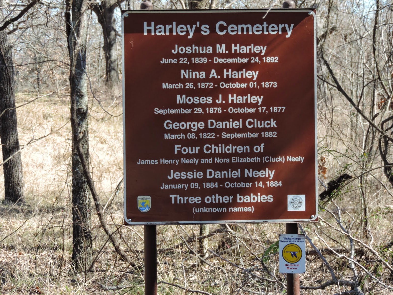
The Park is sobering, very much like Gettysburg, with monuments and historical markers and 17,000 graves; 12,000 of these interments are unidentified. The physical landscape also reminded me of Gettysburg with hills and gullies and fields and trees. Today, all is pristine and quiet; the blood and guns and screams and smoke and horses and mud only in books and movies and artwork. The actual cemetery is an area adjacent to the far loop of the auto route, next to the USS Cairo Gunboat and Museum. The Cairo was one of seven ironclad gunboats and was sunk in the Yazoo River near Vicksburg by the Confederates where it lay in the mud for over 100 years before being raised and restored. It is a tale very similar to that of the steamboat Bertrand on the Missouri, which also sunk and was found 100 years later and is now at De Soto NWR in western Iowa. A Japanese family was visiting and three young girls were frolicking on the short wall at the Cairo site.
USS Cairo Gunboat and Museum - Vicksburg - MS

Thousands of the grave markers are modest weathered four to six inch stubby stone squares. They are not in one grand field but in orderly groups of hundreds on the hillsides and under the trees. One of the books I bought was specifically about the battles at Gettysburg and Vicksburg.

The Park should be a wonderful birding venue in a month.

I ate out once, at See's, which offered "hibachi or Chinese" as I walked in the door.

Starting to get cabin (motel) fever, I found an independent bookstore downtown - Lorelei Books, whose logo is of a mermaid reading a book. I went there twice and now have enough books about the South for several months of reading....on politics, trees, the blues, cotton, bayous.....and I also got the Kristof / WuDunn book, Half the Sky.

The owner is a woman named Laura who moved to Vicksburg from Virginia Beach 10 years ago after visiting her sister several times when her sister lived here. The bookstore was perfect...really a lovely place with light wood, a few solid pieces of furniture, good lighting, a great book selection, a couple of stealthy resident cats, and a few non-book products. One was made by Uncle Goose from Grand Rapids, Michigan....handcrafted wooden blocks using Great Lakes sources. Another product was beautifully sewn little quirky fabric dolls made by a Vicksburg lady who inherited a sewing machine and her mom's button collection....(Eunice, I thought of you with your sewing skills and creativity and an inherited button collection...)

If anyone ever goes through to to Vicksburg, please stop by. The store is on Washington Street, a couple blocks up from the river. The owners live upstairs. There is a coffee shop next door where folks were playing chess, working on computers,  reading.... It was like a West Coast or college town coffee shop, at the other end of the spectrum from a Starbucks but with good coffee and an efficient barista...a dark, cluttered, cozy place with used books and eclectic stuff on the walls. Local, both of these businesses.....

Laura and I talked about small town politics and Mississippi and how the Vicksburg "ex-pats" hang out together. She had just started a book club but had to reschedule the first meeting due to the hazards of ice and snow. She loves poetry and hosts poetry readings. One poet she mentioned was Gail White, a medical technologist who also writes poetry. Laura said how people enjoyed Gail's visit because many people are afraid of or dislike poetry "as they expect a metaphor to come out from every bush... but Gail's work isn't like that."

I told her Vicksburg was seducing me and she said I should move down and "join us."

She knew of Politics and Prose in Washington DC. In fact, one of her customers, now a retired lawyer, used to live there and frequented P and P.
Lorelei bookstore - Vicksburg - MS

How does she select books?  "Well, that is an interesting matrix of a discussion...." Reviews of course; her own and customers' interests; prepublication galleys; trade magazines; best sellers....

A white, multilevel paddle-wheeler, The American Queen, was tied up in Vicksburg that day, so I got to see it and the several tour buses who were bringing passengers (most under black umbrellas) back from the Military Park and the Historic District or wherever else they went.

A couple at breakfast in the motel one morning were driving the Natchez Trace. I laughed when I heard a woman  say that the waffle was probably "infinitely better" than the sweet roll and thus started a conversation. They lived in Portland, Oregon, and we spent some time sharing traveling stories. The gentleman had been in the Coast Guard, at sea for six of his 24 years. He had a very courteous intelligent
demeanor and listened as much as he spoke.

He had been in every state and also told me about Canada's Red Coat Trail running through Saskatchewan, Manitoba and Alberta, an 800 mile route used by the Royal Canadian Mounted Police in 1874 as they moved west establishing law and order for the settlers who followed. Their next grand adventure (they said) was Australia or maybe a "slow boat to China...." The lady was attractive with a teasing twinkle in her eye as they talked about ex-Govenor Kitzhaber (Oregon) who joined the cadre of men who get in trouble because they "follow their who know what" she said.

The American Queen - Vicksburg - MS
The motel had a nice pool right off the lobby where I went every afternoon with my computer, sitting under plastic trees by the blue blue water. No one ever used it, though I was tempted.

I have been called Ma'am at least 200 times lately and even "Mum"by one of the sweet housekeepers who kept me supplied with coffee and fresh towels and would have gladly done any upkeep I asked. All of the staff were African-American....but the owner was East Indian.

On Tuesday morning, my car was completely frozen shut with an inch of snow/ice covering it, but it thawed by noon enough to open the doors.

One evening I chatted briefly with a guy in the lobby who works for a utility company down here but lives in Traverse City and is looking to move his family to Holland. "In fact, we just starting looking last week for a house...." He had iPhone photos of this year's snow caves on Lake Michigan and I showed him Big Red on my phone.

Mostly I worked and read Unbroken by Hillenbrand, a truly incredible tale.

And I watched the Academy Awards.....Lady Gaga and Sound of Music tribute and Julie Andrews; Neal Patrick Harris's grand opening number....the nuttiness of the Red Carpet and the gowns, many beautiful but some seriously weird. (Some bitchy woman on a different show said that the necklace Scarlett Johansson wore looked like a bunch of "seaweed" and I sort of agree.) I hadn't realized Reese Witherspoon had been a nominee for Best Actress and was happy for her as I loved the movie Wild. And just all of the hoopla leading up to the final awards. Why are so many of those who work behind the scenes to get a movie made foreign born?
Vicksburg Military Cemetery - MS


Wednesday, February 25, 2015

Blue Goose ~ Day 269

February 20, 2015 ~ Tallulah, LA to Vicksburg, MS

I am always relieved when my mail (kindly sent by Dave VH to General Delivery in towns of my choice) is actually there. I choose small towns and only have to pay attention to the hours of operation as some close at noon for lunch or are just open in the afternoon. So far, there was a glitch only at the first pickup, but it was minor as they did in fact find my mail when they searched a little harder.

And then I went to Tensas (pronounced Tin-saw) NWR which is where Ivory-billed Woodpeckers were last unequivocally confirmed.

Ivory-billed Woodpeckers in display case at Tensas NWR - LA


WWW.CORNELL.BIRDS.EDU
In the spring of 1924, ornithologist Arthur Allen, founder of the Laboratory of Ornithology at Cornell, was traveling with his wife Elsa in Florida when they decided to check out an alleged sighting of an Ivory-billed Woodpecker. Ivory-bills had not been seen for several years. The Allens managed to find a pair and decided to study the birds by observing them but elected not to camp nearby for fear of disturbing what might be the last nesting pair. Much to their dismay, a pair of local taxidermists got a permit and shot the birds legally while the Allens were away. 
In the early 1930s Mason Spencer, a state legislator from northeastern Louisiana, shot a male ivory-bill in a huge tract of virgin timber, known as the Singer Tract, along Louisiana's Tensas River and word went out to the ornithological community.  
In 1935 Allen organized the Brand-Cornell University-American Museum of Natural History Ornithological Expedition. The expedition--including Cornell professors Arthur Allen and Peter Paul Kellogg, James Tanner, a graduate student, and bird artist George Miksch Sutton, who was also an ornithologist and curator of the Cornell bird collection--traveled across America to record motion pictures and sounds of vanishing birds.
One of the goals of the 1935 expedition was to check out the 81,000-acre Singer Tract where Mason had shot an Ivory-billed Woodpecker. After grilling Spencer about his sighting, the expedition headed into the swamp led by Jack Kuhn, the local game warden. After three days in the swamp, the expedition found an ivory-bill nest 40 feet above the ground in a cavity in a red maple. 
"The whole experience was like a dream," wrote Sutton in his 1936 book Birds in the Wilderness. "There we sat in the wild swamp, miles and miles from any highway, with two ivory-billed woodpeckers so close to us that we could see their eyes, their long toes, even their slightly curved claws with our binoculars." 
Allen set up Camp Ephilus--a play on the scientific name of the ivory-bill (Campephilus principalis) --within 200 yards of the nest and kept watch, recording every detail of the birds' behavior, for a couple of weeks. Peter Paul Kellogg had stayed in town moving all of the equipment from their truck to a wagon that would be hauled to the campsite by mules. It was impossible to get a motor vehicle into the swamp 
When Kellogg arrived, he and the crew produced the first motion pictures and sound recordings ever made of the ivory-billed woodpecker.

The sounds of the ivory-bills captured by Kellogg in 1935 are the ones still used for playback today by ivory-bill searchers. They are also the sounds against which modern recordings of possible kent calls are checked. 
 
From 1937 to 1939, Jim Tanner spent two years studying ivory-bills in the Singer Tract and searching for them across the South as part of his PhD dissertation for Cornell. Funded by the National Audubon Society, Tanner produced an in-depth report, which was later published as The Ivory-billed Woodpecker. In 1939 Tanner estimated there might have been 22 to 24 ivory-bills remaining in the United States, with not more than 6 to 8 birds at any one place. Although Tanner spent months checking out sightings of the ivory-bill around the South, the only birds he ever found were in the Singer Tract. He concluded that the only hope of saving the species lay in preserving that ancient forest. 
The Singer Tract (named after the sewing machine company who owned the land) was the largest piece of primeval forest left in the South. The logging rights to the Singer Tract had been sold to the Chicago Mill and Lumber Company. The National Audubon Society mounted a campaign to save the Singer Tract but it only accelerated the rate of cutting. The Chicago Mill and Lumber Company had no interest in saving the forest or compromising with John Baker, the president of the National Audubon Society. Baker wanted to buy the rights to the trees and obtained a pledge of $200,000 from the governor of Louisiana for that purpose.
The lumber company refused the offer and the Singer Sewing Machine Company, which still owned the land, refused to intercede. Richard Pough, who later became the first president of The Nature Conservancy, was sent by Audubon to search for the remaining ivory-bills in the Singer Tract in December 1943-January 1944. In a letter to John Baker he wrote, "It is sickening to see what a waste a lumber company can make of what was a beautiful forest." He found one female ivory-bill in a small stand of uncut timber, surrounded by destruction.
 
The artist, Don Eckelberry, who also worked for Audubon, went to the swamp in April 1944 looking for the bird Pough had spotted. He found her at her roost hole and spent two weeks watching and sketching her. Eckelberry's time in the swamp is the last universally accepted sighting of one of these birds in the United States. 

The paved road into the refuge ran above the slow-moving, opaque, mud-colored river. I parked several times watching birds from my van, easily getting a dozen species, including the IBWO look-alike, a Pileated. I did not see one vehicle in two hours. It was warm enough, overcast without even a hint of a breeze, very tranquil....a memorable morning with the ghosts of Ivory-bills on the periphery of my consciousness.
Tensas River - Tensas NWR - LA

In the large VC, I was surprised and thrilled to see a pair of IBWOS in a display case along with an old movie of a female vigorously working a large cavity.  I asked if I could photograph the birds and was given permission. The thing is, these specimens had been displayed at Cornell originally but were then "filed" away in a bird specimen drawer. Tensas asked for them. After a lot of paperwork and negotiation, they received the woodpeckers on loan and eventually took possession permanently. Which is where they should be, given the history. The office manager was a friendly African-American woman who had worked there for "oh...30 years or so..." She lives in Talullah, 20 miles away. I thought of watching 30 years' worth of changing seasons on a refuge like this. Northern Mockingbirds were flying about as I stepped outside....

Tensas is an 80,000 acre refuge in the Mississippi Delta established for the purpose of protecting and managing hardwood bottomlands. It also has arrangements with local farmers who plant and manage refuge croplands and who, at harvest, leave 20% for wildlife. This practice is not unique to Tensas, and the cooperative effort benefits wildlife and local farmers. Nesting boxes are put up for Wood Ducks; 150 are banded each year. Reintroducing and protecting the endangered Louisiana Black Bear is another focus.

Tensas NWR- LA
Two other species historically found here are the endangered Red Wolf and the Florida Black Panther both of which are no longer resident due mainly to loss of habitat but at least are not extinct (yet).

There was a short auto route running through a swamp adjacent to the refuge where I saw ducks and Great Egrets (looking especially pristine in the grey-brown woods) and then continuing through open fields full of sparrows. Frustrating sparrows.

It was Friday and I headed for Vicksburg, just across the Mississippi, where I stayed for the next six days, mostly because of inclement weather. As there was enough work to do, I settled into a pleasant Best Western, working and watching grey skies and rain and ice and snow.


Red-bellied Woodpecker - Tensas NWR - LA


Tuesday, February 24, 2015

Blue Goose ~ Day 268

February 19, 2015 ~ Bastrop, LA to Tallulah, LA

I needed gas but turned into three stations before I found one that had a card reader at the pump. I am way to lazy to walk into the station to pay. How lucky I've been that gas prices are about half of what I thought they would be for much of my trip, averaging close to $2.00 per gallon.

It was good I filled the tank because the Upper Ouachita NWR was much farther than I expected. I first had to find the little town of Haile, turn on Haile Baptist Church Road and continue to the refuge, which I did, finally finding the headquarters.
On Haile Baptist Church Road on the way to Upper
Ouachita NWR - LA

The sun was out and no one else driving the route I took through the refuge. I have come to love these roads that meander through the woods and swamps and along rivers, listening for birds, seeing deer or the occasional coyote or fox, hearing nuts, twigs and other tree detritus drop on the perfectly still days, listening to the dry leaves rustling as sparrows and thrashers poke around, hearing the wind in the canopy and the very subtle noises that birds make as they look for food. At a boat landing, dozens of meadowlarks were foraging on the ground. I never see meadowlarks in this type of place; they are always in the fields, but here they were, easily spooked as I approached, flying in a group to the trees but soon coming back down to the grasses. The woods had an abundance of kinglets, titmice, etc. and I saw my first Blue Goose trip Eastern Towhee here. There has also been at least one Hermit Thrush if I wait long enough.  And many Eastern Bluebirds, so pretty perched on low branches, showing their rust and white bellies or their blue backs. To me, blue is an incongruous color in the woods. It's not that common and always gives me pleasure.
Hermit Thrush - Upper Ouachita NWR - LA

I feel the birds and I are on the cusp of spring, both getting impatient. There is the certain knowledge that more light and warmer days are imminent. The stubborn cold cannot hold much longer. (Bear with me....I think weather talk/perseveration is a digital thing for people; either one does or doesn't.)

Carolina Wrens are another common bird, the males singing a loud rich, very distinctive song, such that even I can recognize it. I'm not good at memorizing bird vocalizations but then again, I don't list or count "heard only" birds.

I went on to D'Arbonne NWR just south of Upper Ouachita and drove around there also, parking near a boat ramp and watching robins eat berries in the sunny woods and a pair of Savannah Sparrows that didn't dive for cover but calmly sat on a nearby tree branch. Of course I looked for the Red-cockaded Woodpecker....in vain. The D'Arbonne name here in Louisiana came from Jean Baptiste D'Arbonne, a French Canadian explorer and hunter in the early 1700s.

In times of high water, nearly 90% of  D'Arbonne is flooded as it is part of the Ouachita River overflow, so again, it's all about the water.....

The national record Mayhaw tree (known for berries that make a delicious jelly) and Rafinesque's big-eared bats are found in this refuge. So much happens in the NWRs with regards to protecting species other than birds. For instance, there are several closed-to-the-public "bat refuges" in these states. There are wildflowers, butterflies, insect, salamanders, trees, snakes, squirrels, black bear and beavers and bobcats, ocelots....hundred of species that the loggers can't disturb and for which staff on the refuges work to protect and enhance habitat.

I needed to get to Tallulah to get my mail, so I drove east nearly to the Mississippi and stayed in a motel there. A rather dismal motel but with evidence of recent upgrades. This must be a dynamic process, constantly keeping motel rooms clean, safe and attractive with the expected amenities. Of course, the upscale chains (3 stars and up) usually are very comfortable, but with the lesser chains (less than 3 stars), rooms and the extra vary greatly. Some are surprisingly pleasant, and some are pretty dreary and only superficially clean. Lighting, bathtubs, an ergonomically designed situation for computer work, computer connections,  door locks, window coverings.....I wonder if the Japanese pod-style hotel would ever work in America....for those who only want a comfortable bed and a bathroom. Modern, tiny, clean, comfortable and inexpensive rooms for a night.

At the turn-off to Upper Ouachita NWR - LA


Monday, February 23, 2015

Blue Goose ~ Day 267

February 18, 2015 ~ Texarkana, AR to Bastrop, LA

Feeling rested, I continued this morning, going east in sunshine on a main road with little traffic. It is only on the secondary roads all through here that the logging trucks make one drive with extreme caution. They carry medium- to small-sized logs and are very different from those seen out west. Here the trees hang over the end of the trailers on a downward slant and have small twiggy branches with greenery still attached, blowing in the wind as the trucks go 70 mph down narrow two-lane roads with no shoulders. It's crazy how fast they go and how much logging is occurring. I constantly passed denuded clear-cut and very messy places, with unsalvageable logging litter scattered about, leaving the land bereft and open.

Felsenthal NWR is described on the FWS website as a "low lying area is dissected by an intricate system of rivers, creeks, sloughs, buttonbush swamps and lakes throughout a vast bottomland hardwood forest that gradually rises to an upland forest community." 
Ouachita River - Felsenthal WR - AR

The waters of the Ouachita River flow through this refuge about halfway in its course from headwaters in the Ouachita Mountains in west central Arkansas to the Tensas River in Louisiana and then ultimately to the Mississippi. 

WWW.WIKIPEDIA.ORG
Below Lake Jack Lee, the Ouachita continues south into Louisiana. The river flows generally south through the state, collecting the tributary waters of Bayou Bartholomew, Bayou de Loutre, Bayou d'Arbonne, the Boeuf River, and the Tensas River. The river below the junction of the Tensas is called the Black River in Catahoula Parish and Concordia Parish until it joins the Red River, which flows into both the Atchafalaya River and the Mississippi River, via the Old River Control Structure.

I like the names of things down here...the bayous, Atchafalaya, parishes (counties elsewhere)...and am intrigued when I see words like the "Old River Control Structure." I think the solid ground of half of the states of Mississippi, Louisiana, Alabama, Florida and Georgia has been claimed from swamps and tidal marshes. It is so WATERY everywhere. The road beds are all elevated to varying degrees.  

Lake Jack Lee is the reservoir adjacent to Felsenthal. The Ouachita has five major dams. So, when a watercourse claims the distinction of being a free-flowing river, pay attention. It is not common, especially on our major rivers. I think bodies of water created by dams should never be called "lakes" but always "reservoirs." Just a personal bias in favor of original and natural water features.
Felsenthal NWR - AR

I only drove to one river access point on Felsenthal and then checked in at the large VC, which was situated in a lovely sun-dappled grove of trees. Pine Warblers were foraging here also in the parking lot. Felsenthal does what many of these southeastern refuges do, and this includes managing for the Red-cockaded Woodpecker. Savannah-like areas are created in long-needled pine habitat and man-made nesting cavities are provided. In addition, they mess around with water and hunters and invasive species eradication, migratory waterfowl, resident species...always working to optimize habitat for flora and fauna. At Felsenthal, feral swine are also a concern causing all kinds of problems, including issues with hunters, which is one more thread on the Internet that distracted me. Check it out if you are interested. Feral hogs are increasing and are problematic. 

I am ignored when I go into the Visitor Centers lately, but that is in part my fault as I don't try to find staff, and there often is no one at the front desk. I think visitors are a minor annoyance at some refuges, and while courteous if someone does poke their head out of offices, they mostly just want to tend to whatever it is they do.  But there are other refuges which welcome visitors and are genuinely grateful that someone is interested and seeks them out. 

I found a motel in Bastrop where I worked a few hours. There has been been little relief from the night-time freezing temperatures and a dismal forecast for the next several days. This, also, I did not expect so far south.  


Sunday, February 22, 2015

Blue Goose ~ Day 266

February 17, 2015 ~ Texarkana, AR

I stayed in Texarkana all day, with a Starbucks break in late afternoon....working and relaxing and reading.
Red-winged Blackbirds - Holla Bend NWR - AR

Snow Geese - Holla Bend NWR - AR

Blue Goose ~ Day 265

February 16, 2015 ~ Paris, TX to Texarkana, AR

Paris, Texas and Harry Dean Stanton...why did I remember this bit of trivia?

I have been in and out of a few of these southern states lately and went back into Oklahoma and then Arkansas today.  The decision was due to that fact that I was to pick up my mail in Tallulah, LA, but hadn't allowed enough time for it to get there, so had to "spend" a few days somewhere waiting on the USPS. After looking at my NWR map, I had a revised plan...well, not exactly revised, since there wasn't much of a plan to begin with; thus, the western loop. Which was fine as I saw some good property.

Some of the refuges are less accessible than others (harder to find), and Little River seemed like one of those, but a main highway runs through it, so I could at least say I was there as I drove across it. But then, between the towns of Broken Bow and Idabel, I came on an access point sign so drove in. This is another area where rivers at one point defined immutable state boundaries, and when the rivers re-channel after floods, the state lines don't. So there are out-pouchings of Texas into Arkansas reflecting the original river bed and vice versa. Hunter's therefore  have to have licenses in both states in these areas. I love the whimsy of this situation.

Little River NWR - OK
Little River NWR 13,000 acres of hardwood bottomland along the Little River, a tributary of the Red River. It has 11 state champion trees and is one of the few places in the Oklahoma where Swainson's Warbler nests. The woods are home to deer and raccoon, bobcat and beaver and squirrels. It has both a southern and a northern feel depending on the elevation. The roads were a pale burnt umber (one of my Dad's favorite oil paint colors) with pot holes filled with rain water.

I moved on into Arkansas to Pond River NWR, a frank hunting refuge. I am getting used to the priorities, or at least not surprised. I saw about 50 White-tailed Deer who would stare at my approaching vehicle before bounding into the woods and disappearing. I saw my dozen species by stopping and waiting for ten minutes when twitters and twitches in the branches would begin as birds resumed their flying and foraging.

It was late afternoon and overcast. The plan was to drive through the refuge as the road emerged back on the highway to Texarkana where I planned to spend the night. The route was gravel but smooth, wide and well maintained, without ruts, holes or significant stones.

Pond Creek NWR - AR
(there was some of this habitat but also drier upland woods)
The map was accurate and I passed the marked campsites and lesser roads, got on Bee Gum road, kept going, figuring I was getting close to the highway, which I was, except there was a river between it and me, and the road ended there. Hmmm... I checked map closely again; there was a tent symbol at the river obscuring the bridge I was certain would be there but wasn't.

Nothing to do but retrace 10-12 miles being careful not to get turned around.

The Best Western on the Arkansas side of Texarkana (the city straddles the Texas - Arkansas state line) was such a deal and so comfortable that I stayed two nights. There was enough work for me from Kalispell, so I didn't feel guilty since it paid for my stay.

Pond Creek NWR - AR
(You know you're on a hunting refuge when this is the first sign in the information kiosk.)

Thursday, February 19, 2015

Blue Goose ~ Day 264

February 15, 2015 ~ Sherman, TX to Paris, TX

The goal for today was Hagerman NWR, west of Sherman, on one of the southern arms of Lake Texoma. As I knew it would, the fine weather of yesterday was changing to cloudy and colder with wind and intermittent spitting rain which eventually became steady.

Hagerman has a bright and lovely VC overlooking the fields and water of the refuge. Two women were working and greeting visitors. A vase of red tulips on the counter was a "present to myself for Valentine's Day" one of them told me. I then asked what town in the US is most associated with tulips and she knew immediately. When I told her what I was doing (after they asked if I were visiting someone in Texas), she said that this is what her Dad liked to do....take his kids to NWRs. She had been at a few and mentioned Blackwater NWR where the highlight on that visit was "meeting the Stokes" who had done a presentation there. So she at least knew something of the birding world as this husband and wife team have written many field guides.

One of the ladies mentioned a few of the recent sightings at Hagerman, including a Bald Eagle.
Wilson's Snipe - Hagerman NWR - TX

A young woman working the desk at a motel a few weeks ago had never seen a Bald Eagle, and when I checked my bird app for her area, surprise, there were no eagles nearby. I had mistakenly assumed she just didn't get out in habitat.... I see them frequently and have become blasé. She was thrilled to even see photos.

As soon as I began on the auto tour, I started seeing oil wells and later learned that Hagerman has about 125 active pumping oil wells on the refuge!

Hagerman NWR - TX
In fact, the USFWS service has five employees whose job is to keep oil and gas activities on public land safe and legal. I had to laugh....this is SO Texas. Like Alabama for Joanie VH, Texas attracts and intrigues me but sometimes repulses. It is brash and muscular but also celebrates its wildflowers and its birds. Texans are proud of their bluebonnets and oil...a complex state that doesn't apologize. For what is described as an "epic" novel set in Texas, and which was a finalist for the 2014 Pulitzer Prize in Fiction, I recommend The Son by Philipp Meyer.

The highlights on Hagerman were Wilson's Snipe, and seven Ross's Geese and one Snow Goose together in a green field and near the road making their respective field marks so much easier than when these species are in distant crowded flock. And suddenly, a Roadrunner appeared from the grasses and actually starting running very fast up the road.
Ross and Snow Geese - Hagerman NWR - TX

Hagerman is fittingly an "overlay" of the Mineral Arm of Lake Texoma and is on one of the four major migratory bird flyways in the US.

(I actually don't know what an overlay is but keep reading that this is what the last few refuges are; the term is used in connection with projects of the Army Corps of Engineers.)

I have been paying more attention to hunting and fishing activities allowed on refuges lately. The Hagerman NWR leaflet states:

WWW.FWS.GOV
On national wildlife refuges, wildlife comes first. The establishment purpose of the Hagerman National Wildlife Refuge is to provide and manage habitat for migratory birds, wildlife, and plants native to this area, and to provide opportunity for outdoor recreation that is compatible. The refuge offers wildlife-dependent recreational opportunities, including wildlife observation and photography, fishing, hunting, and hiking, and educational programs.
I am curious if hunting is a contentious issue with wildlife managers and who makes the decisions about what can and cannot be "harvested" and if it's mostly about revenue from hunters.

As I drove to Paris, I listened to a lecture on relative versus objective truth that was surprisingly refreshing when compared to most of the preaching which is so prevalent on the radio in the South. And also actually listened (for about 15 minutes) to The Gospel Station where the Christian music was presented in musically diverse genres by talented musicians. Mostly, though, I listen to public radio, always happy when a signal lasts more than 30 minutes. Once in a great while, I happen on a blues or jazz station. And I do have CDs.

I got to Paris just before dark and had a couple of enchiladas for dinner. I stayed in a motel again, but am mostly paying for this by working four to five hours. Cold, wet, treeless parking lots have lost whatever appeal they had, or which I at least tolerated. And the low temps are setting records in the south.

Wednesday, February 18, 2015

Blue Goose ~ Day 263

February 14, 2015 ~ Okmulgee, OK to Sherman, TX

Well, yes, I did feel better after my marathon sleep. I showered, ate breakfast and went to Deep Fork NWR. The directions took me past the intersection of Lavender Street and Mint Avenue. It was early but the sun was rapidly warming the exposed areas and I hiked an hour. Lately, I've been trying to see at least 12 species of birds at a refuge. This really is a modest goal but it slows me down when I get in that restless mode, feeling the urge to keep moving too quickly from place to place.
Cardinal at Deep Fork NWR - OK

The avian stars this morning were Red-headed Woodpeckers and Tufted Titmice which were all over, at least a dozen of each. And I saw lovely cinnamon-colored birds: a Carolina Wren and Brown Thrashers, along with cardinals, other woodpeckers species, a few ducks, Ruby-crowned Kinglets... I started on a boardwalk off the parking lot before taking the Girl Scout Trail through the woods. It happens all the time....I begin walking, kind of preoccupied, carrying on the inner dialogue, picking apart all the bits and pieces of my life and the people in it, planning the day, what I will do next, etc., and then quite suddenly I feel the sweet balm of nature surround me and give in to it. Most of the disorganized and distracting mind musings smooth out or disappear.

This refuge manages hardwood bottomlands along the Deep Fork, a river in the Mississippi watershed. By the 1980s, 85% of Oklahoma's 2.2 million acres of lowland hardwood habitat had been cleared (USFWS). Not surprising, as I see several loaded logging trucks every day, driving too fast on the two-lane roads.

Most refuges have at least one trail or boardwalk that is wheelchair-accessible. And it is true, as is pointed out nearly everywhere I go, that one's vehicle is the best way to observe wildlife; therefore, auto-routes of varying lengths are maintained (although to varying degrees). Since water management is a priority, the roads will sometimes have dips or low places where water moves across depending on the season and what the managers are doing. These areas are paved with short segments of concrete. So far, I've avoided heavily inundated roads (which would be closed by the staff anyway) and only occasionally have to drive through an inch or two of flowing water.

Tishomingo NWR - OK
I moved south and slightly west to Tishomingo NWR and walked a mile trail. The refuge is named in honor of Chief Tishomingo and had once been the site of a Chickasaw boarding school, the Manual Labor Academy, mostly funded by what is still known as the Chickasaw Nation.

Lake Texoma is the huge reservoir created when the ACOE built the Denison Dam on the Red  River. Tishomingo borders one of the northern arms of this sprawling lake; therefore, fishing for crappie and catfish is a major attraction at Tishomingo. And just because these facts are interesting to me:

WWW.FWS.GOV
Blue catfish will nest in hollow logs, holes under mud banks and underwater ledges. The females will lay up to 10,000 eggs, which are then guarded by the males, who keep intruders away -- including the female. Between six and 10 days later the eggs will hatch and the young fry are looked after by the male who stays around for a short while. Feeding in dense schools when they are young, the fry will grow up feeding on mussels, insects, fish, snails and crayfish and may one day weigh as much as 100 pounds.

It was 71 degrees as I went on to Sherman, TX, and I relished the warmth as it wasn't going to last. I worked at a motel after spending time at the next-door Starbucks where I had a chicken sandwich which was dinner.

Tishomingo NWR - OK

Tuesday, February 17, 2015

Blue Goose ~ Day 262

February 13, 2015 ~ Russellville, AR to Okmulgee, OK

Feeling nauseous, I dug out a Compazine which always takes two hours to work, but I slowly began to feel better by mid morning. And since I couldn't exactly just go back to bed, I went to a National Wildlife Refuge instead, specifically Holla Bend in western Arkansas.

Sunrise at Holla Bend NWR - AR
When the Army Corps of Engineers (the ultimate water boys) straightened a bend in the Arkansas River, the U-shaped Holla Bend was cut off. I drove around for a couple of hours, gratified that at least they put "Wildlife Observation" on their refuge sign of permitted activities before "Hunting" or "Fishing" although Holla Bend is a "ducks and geese" refuge. I saw another huge flock of Snow Geese in a field and and equally large groups of blackbirds, mostly Red-wings, which would settle in trees or fields or on the road, and then suddenly take wing and fly about, moving en masse in lovely swooping configurations before settling again, generally hyperactive and vocal this time of year...very evocative of imminent spring.

By noon, I was in the Cherokee Nation, the country of the "civilized" Indians, these being the Cherokees, Chickasaw, Creek, Choctaw and Seminoles who were removed from their more eastern traditional homes ultimately settling in eastern Oklahoma. They were considered civilized because they adopted and adapted to white European ways better than the "wild" tribes. So much history here, and it usually brings me up short when it involves Native Americans and their displacements.

The Trails of Tears.....

WWW.NATIONALHUMANITIES.ORG

The final removal came under the Indian Removal Act. Missionary societies who had invested their time and money teaching Indians to live with their white neighbors and accept Christianity lobbied Congress to oppose the act. It finally passed, but only by a one-vote margin, in September of 1830. The Choctaw, Cherokee, Chickasaw, Creeks, and Seminoles signed treaties agreeing to leave their homes in the southeast and move west. Their travels were marked by outbreaks of cholera, inadequate supplies, bitter cold, and death from starvation and exhaustion. The Cherokees' march was a forced one under the direction of the United States army, and it came to be known as the "Trail of Tears" or, in their own term, "The Place Where They Cried." 

Sequoyah NWR is at the confluence of the Arkansas and Canadian rivers in eastern Oklahoma. It is the result of another ACOE (Army Corps of Engineers) project to "tame" the Arkansas river after a devastating flood in 1943 and is named after a Cherokee silversmith, Sequoyah, who in 1821 completed a syllabary for the Cherokees so they could read and write in their own language.

Again, I just drove slowly for a couple of hours through this refuge, stopping often. It was one of those early spring days with the sky a soft, soft blue...

Sequoyah NWR - OK
I was headed to Deep Fork NWR, but was too tired to visit by mid afternoon so continued a few more miles to Okmulgee where I got a motel with a wonderful west-facing room, overlooking fields (my favorite motel situation). I intended to work. The sun was shining brilliantly on the heavy textured white cotton bedspreads, so I laid down to nap for a bit and fell asleep for 14 hours. Delicious!


Monday, February 16, 2015

Blue Goose ~ Day 261

February 12, 2015 ~ Stuttgart, AR to Russellville, AR

A sign in the motel offered to "Pluck Your Ducks" at $4 per. They picked up in the evening and dropped off the next morning. There was also an option re the duck breast which I've already forgotten.

Not far from Stuttgart is Cache River NWR....

WWW.FWS.GOV
FOR IMMEDIATE RELEASE
April 28, 2005
( WASHINGTON) – Responding to the dramatic rediscovery of the Ivory-billed woodpecker at the Cache River National Wildlife Refuge in Arkansas, Interior Secretary Gale Norton and Agriculture Secretary Mike Johanns today announced a multi-year, multi-million-dollar partnership effort to aid the rare bird’s survival. The bird has been thought to be extinct in the United States for more than 60 years.
“This is a rare second chance to preserve through cooperative conservation what was once thought lost forever,” Norton said. “Decisive conservation action and continued progress through partnerships are now required. I will appoint the best talent in the U.S. Fish and Wildlife Service and local citizens to develop a Corridor of Hope Cooperative Conservation Plan to save the Ivory-billed woodpecker.”
 
The “Corridor of Hope” refers to the Big Woods of Arkansas, an area about 120 miles long and up to 20 miles wide in eastern Arkansas where the Ivory-billed woodpecker has been sighted.
The Interior Department, along with the Department of Agriculture, has proposed that more than $10 million in federal funds be committed to protect the bird. This amount would supplement $10 million already committed to research and habitat protection efforts by private sector groups and citizens, an amount expected to grow once news of the rediscovery spreads. Federal funds will be used for research and monitoring, recovery planning and public education. In addition, the funds will be used to enhance law enforcement and conserve habitat through conservation easements, safe-harbor agreements and conservation reserves.
This was huge news and, while the IBWO(s) seen that spring are now generally believed not to have been IBWOs, most birders have hope they are deep in some swamp...somewhere....can almost visualize the flashing white wings....

I drove into the first Cache River access road that I passed to see this information at the kiosk:
Cache River NWR - AR

The river is formed by a "confluence of agricultural ditches" in southeastern corner of Missouri and then runs south through Arkansas roughly parallel to the much large White River which it joins before the White enters the Mississippi River.

The refuge office was a plain and humble converted farmhouse. Becky came out of her office (she does "budget all day") to talk with me, and was obviously happy to do so. She has worked 20+ years for the FWS and currently lives 40 miles away, necessitating an 80-mile daily commute, which she doesn't mind..."It gives me time to think..."

She was envious of my adventure, as I find many women are.

Of course I asked her about the excitement of a decade ago. She said that it WAS a crazy time....access to the refuge was closed for a time and birders were angry...all kinds of people showed up. She figured that if the birds were still around, someone would (by now) have unequivocal proof....yet she occasionally hears from people she totally respects that they have seen an Ivory-billed but are reluctant to report it. She said the inquisition that follows, with the assumption that the sighting was unreliable and not valid, makes people reluctant to come forward. No, she said, the locals never report anything. Really, "No one talks about it much anymore...."

She gave me a hug as I left, giving me information about other Arkansas refuges, her eyes twinkling, her smile sending me on my way.

Bald Knob NWR was formerly rice fields owned by the John Hancock Insurance Company who sold it to the government. It reminded me of the North Dakota refuges with its partially flooded fields and flat land. Dozens of meadowlarks were in the fields, and at least dozen Wilson's Snipe fed near the road on this early spring day. There is always a Northern Harrier or two cruising low over the land wherever I stop, their white rumps distinctive.
White-crowned Sparrows at Bald Knob NWR - AR

I stayed in a Flying J truck stop (which I actually like better than Walmart parking lots) but had a restless night as the stomach cramps kept me awake. I kept thinking I should probably go to a motel but it seemed too much effort. By morning, I was also feeling slightly nauseous and just wanted the sun to rise.


Sunday, February 15, 2015

Blue Goose ~ Day 260

February 11, 2015 ~ Greenville, MS to Stuttgart, AR

I spent a delightful morning driving The Great River Road north from Greenville with a two-hour detour east a few miles to Dahomey NWR where I drove back into the woods for three miles, stopping intermittently to see what birds were about. Dahomey was first leased and then purchased from The Nature Conservancy. After the capricious flooding of the Mississippi was controlled by the construction of levees along the river, wetland habitat suffered. Dahomey is addressing that...water, water, water....again. The woods were half swampy. All was quiet on this sunny morning....peaceful and sort of perfect for an hour of down time. I feel blessed to have inherited the gene that recognizes nature's soothing power. Cardinals flit wherever I stop, along with an assortment of titmice, woodpeckers, kinglets and sparrows, and an occasional thrasher or warbler. Crows, hawks and vulture cruise overhead. I love how some birds rustle in the dry leaves and how sometimes that is the only sound.

It was a lovely morning with little traffic and only a few small towns. The river levee was usually in sight on my left, and I drove up on it at one point, hoping to see the Mississippi, but I only saw bottomlands with a messy mix of trees, tangled brush and dried mud. I read Rising Tide (not The Rising Tide) years ago but need to re-read it. The land is all planted in cotton, and gigantic farm machines were discing and plowing and doing whatever it is they do to prepare for planting.
On the levee near Alligator, MS
On the map, the Mississippi is tortuous, meandering in S- and C-shapes with numerous oxbows left behind after high water periods, looking like the stranded pieces of river that they are. What is comical though is that the Louisiana - Mississippi boundary (which hereabouts is/was the middle of the Mississippi River channel) doesn't change when the river does. Now pieces of each state project like polyps into their neighbor's state since the main channel used to run that way. Google the town of Alligator, MS to see what I mean. Or follow the river north from Greenville for awhile on your phone map app.

There were many long abandoned small and narrow houses, some nearly covered by vegetation. The Great River Road goes through 10 states and takes four days of driving (36 hours if one drives without stopping).

I crossed over into Arkansas at Helena and stopped at the beautiful Arkansas Welcome Center which had at least a thousand handouts and a staff who were determined to provide travelers with customized trip information, whether they wanted it or not. It is always interesting to meet a person who is inquisitively challenged. They ask questions but do not follow up on answers unless it suits their agenda, which in this case was finding information they thought I would need to continue through Arkansas. I did appreciate the map. When they asked in which town I intended to spend the night, I didn't offer that I was sleeping in my van as that wasn't an option they would have appreciated....bless their hearts...

Moving west from the River, I came to White River NWR which also has been renamed recently to the Dale Bumpers White River NWR. Dale was a Democratic governor of Arkansas and a US Senator for 24 years.

WWW.FWS.GOV
As a U.S. Senator from 1975 to 1999, Mr. Bumpers...facilitated an innovative land exchange to swap Idaho timberland for bottomland forests and wetlands in Arkansas, adding 41,000 acres to the White River and Cache River National Wildlife Refuges. As Governor, he helped stop the channelization of 232 miles of the Cache River and its tributary, Bayou DeView.  
Mr. Bumpers and his wife Betty have been married for 65 years. Together they championed childhood immunization on a national scale. 

He is deserving of honor but I like the usually elegant and simple refuge names without a person attached. Except maybe for the Rachel Carson or Charles Russell NWRs. Isn't Brigantine NWR more descriptive than Edwin B. Forsythe NWR?

The White River refuge is approximately 60 miles long along the floodplain of the White river, and varies in width from one to ten miles. So it's huge and 95% forested bottomlands. I walked the Upland Nature Trail near the VC and part of the Bottomland Trail which goes down to the river. And that's about all except for checking out the VC where an impressive exhibit dominates the main room...a cypress tree in the swamp with all the expected fauna, including a nesting Black Bear and her two tiny cubs.

There are numerous dirt and gravel roads, primitive camping sites, boat launches, and hiking trails up and down the river. It must be an amazing place during spring migration. Many of these southern refuges feature the exquisite Prothonotory Warbler in their brochures, or the equally stunning Painted Bunting. So, White River is a large important refuge, nearly contiguous with Cache River NWR just to the north. Where they meet was the area of the 2004 sighting (or not) of an Ivory-billed Woodpecker that caused the hearts and minds of ornithologists and common citizens all over the world to lighten. Subsequent skepticism prevailed however since no one produced a definitive unchallenged photograph of an IBWO. But this would certainly be the type of remote and wild habitat they could support them.

I pulled up behind a green farm machine which filled both lanes. And then, totally unexpectedly, I came to a field with 10,000 "light geese." I easily saw White and Blue Snow Geese, but there were probably Ross's and Greater White-fronted in the mix.
A few of the 10,000 geese near Suttgart, AR
They were mostly on the ground with hundreds still flying in. The sun was setting, coloring the sky with today's unique palette. That every sunset is different is ensured by the variables of light and clouds and dust and wind and moisture.

In Stuttgart, where I stayed in a motel, I went to La Petite Cajun Bistro (should be Le Petit Cajun Bistro) because the motel had their menu on the desk. The venue was like a church basement or school cafeteria with one large room and tables and chairs with no pretensions other than utilitarian. The owner was the most unprepossessing restaurant owner I could have imagined, especially for this place with better than average food. He had jeans, a bill cap, a T-shirt with some cartoon character on the back. He looked exactly like someone who might work in a small town hardware store. He said his ex-wife came from South Haven. There were high-end foodie magazines on the small bar in the corner, like FSR (Full Service Restaurant). The menu had local "bayou" and seafood specialities, including alligator. I ordered Crawfish Etoufee, sautéed green beans, cole slaw and coconut cream pie. The pie was the best I've ever tasted. The crawfish had a spicy but subtle Cajun seasoning with generous pieces of meat.

With that said, I think I got food poisoning as I woke up with stomach cramps which persisted for the next 36 hours. They weren't debilitating but definitely unpleasant.


Saturday, February 14, 2015

Blue Goose ~ Day 259

February 10, 2015 ~ Madison, MS to Greenville, MS

The Nissan plant just north of Madison, Mississippi is 0.8 miles long!
When the river rises, alternative access is
parking on and walking in from the road - MS

I pretty much drove around the entire Panther Swamp NWR before actually finding the VC where I spoke with a friendly woman who explained the lay of the land here and in the other six refuges of the TR NWR Complex in Mississippi. She appreciated what I was doing on this trip and gave me a little LED flashlight "to remember us by" so, even though this seemed to be another hunter's paradise, she was kind and welcoming which ameliorated some of my fretfulness about hunting being the priority in the last several places I've visited.

She also had the large maps of all the refuges and said she "orders them by the boxful....people need to know we're out here."

In answer to the obvious question about the name, she shrugged; there are not panthers on refuge. Historically, there probably were before white men began messing with the swamp.

What I did was drive the west levee road south for 11.5 miles, which bisects the refuge and is a perfectly straight gravel road built high above the lowland with gently sloping sides, and then drove back on the east levee, seeing a dead armadillo and not much else....a few ducks here and there and a flurry of passerines flitting in the trees when I stopped at one point. But, again, it was midday when most birds and critters are least active. In these nearly 22 miles, I saw no other vehicle.
At the end of the East Levee - Panther Swamp NWR - MS

According to their web page, Panther Swamp's Environmental Education and Interpretation consists of "an annual Kid’s Fishing Rodeo. Hundreds of children participate in fishing, bb and bow shooting activities. Children are provided poles and bait to fish in the one-acre stocked pond."

Leaving Panther Swamp in my dusty van, I went to Yazoo NWR and was able to drive several miles on refuge roads, going through a variety of habitat: marshes and swamps, fields and forests. Yazoo is only five miles from the Mississippi River (as the crow flies). It was late afternoon, and the light made the golden grasses bright against the dark trees. At least this refuge has a Butterfly Garden and the Swan Lake Indian Mound, along with a boardwalk and observation tower. It is the oldest Mississsippi Refuge, established in 1936 and currently has 13,000 acres. It was peaceful. Wood Ducks moved silently through the swamps. But, again, from their webpage: "Yazoo National Wildlife Refuge is also known as one of the premier hunting refuges in the southeastern U.S. For years, hunters have traditionally scheduled their vacations to hunt Yazoo National Wildlife Refuge’s white-tailed deer."
Yazoo NWR - MS

So this has been a revelation: that a National Wildlife Refuge can be a "hunting refuge." Isn't there other land hunters can use, or has it all been cleared for crops? Am I being unreasonable? Waterfowl winter on refuges and then get killed there. 

The populations of what are collectively called "light geese" (Snow and Ross') are increasing at the rate of 5% per year, degrading nesting habitat in the arctic and subarctic. I understand the need to maintain an equilibrium for the general good of all fauna, but when the main refuge activity is hunting, it seems counterintuitive. Keeping a refuge vital and modern is costly, and the monies they receive for allowing "extraction" of their fauna may be one of the reasons they can maintain enough staff. I am just one person, visiting briefly.... Are there discussions and disagreements on this issue amongst the managers and staff? Is that one reason for Wilderness status? 


Thursday, February 12, 2015

Blue Goose ~ Day 258

February 9, 2015 ~ Louisville, MS to Madison, MS

On the way to the "Brake" refuges, I stopped by a little museum in Koscuisko, Mississippi, right at an entrance to the Natchez Trace Parkway, and discovered this is the birthplace of Oprah Winfrey. "You've heard of Oprah Winfrey?" the volunteer gentleman at the desk asked me. I felt like saying "No...who is she?" just to see his reaction.

The town was named after Tadeusz Kosciuszko, an intriguing man who was born in Poland, came to the US to fight in the Revolutionary War with the Americans and was an important architect for West Point. He became friends with Thomas Jefferson "with whom he shared ideals of human rights [and] wrote a will in 1798 dedicating his American assets to the education and freedom of U.S. slaves. He eventually returned to Europe and lived in Switzerland until his death in 1817. The execution of his will later proved difficult and the funds were never used for the purpose he had intended." (Wikipedia)  

I added this most interesting man to the short list of the people I found fascinating while on this trip. 

The volunteer also asked me where I lived, and when I said "Holland" he was delighted as Holland is the only place he has been in Michigan...on a "bank" bus tour at Tulip Time one year. (At least I think he said "bank," but I don't always understand the thickly accented words.) 

Next, I got the oil changed by a man with no personality and a grudging attitude before I went on through pleasant Mississippi countryside, up and down small hills, past open fields and woods. There are country estates with man-made ponds scattered here and there, usually near large cities. 

And then I was in cotton and crop-duster country with kestrels on the wires and killdeer by the dozens in the fields. Everything was muted, and I saw few signs of spring yet...no new buds or leaves, just grayish-brown branches and fallow fields. There was the green of Saw Palmetto in some woods but the landscape was mostly drab.
Cotton fields MS


Here is my vocabulary lately: 

Brake means thicket. 
Bayou means slow moving water usually with an abundance of vegetation.
Slough means a river side channel intermittently filled with water.
Oxbow means a crescent-shaped lake when a "meander of a stream or river is cut off from the main channel" (www.thefreedictionary.com)

There are seven Mississippi refuges in what is known as the Theodore Roosevelt National Wildlife Complex. It seemed to me they are mostly hunting preserves. I was seeing and reading more about hunting regulations and permits to the exclusion of much else on these refuges, with seasons for deer, raccoon, squirrel, rabbit, opossum, coyote, beaver, bobcat nutria, and turkey; ducks, geese, mergansers and coot; fish and frogs. Dogs / Retrievers are permitted. ATVs are allowed, as are hunting blinds. So the term "refuge" is hardly that. And, in fairness, Mississippi isn't the only state to allow hunting on the refuges; most do, but my impression lately has been that the shooting of animals is the main business once they had improved the habitat enough to attract birds and animals. 

I went first to Mathews Brake NWR which was down a dirt road behind a locked gate next to private duck camp.
Mathews Brake NWR - MS
Mathews is small at 2400 acres with no pretension from what I could see that this is anything else than land for hunting and fishing. I proceeded on to Morgan Brake NWR (7400 acres) which did have at least one nature trail; however, their web site states: 


WWW.FWS.GOV
Although occasional visitors stop by to observe wildlife and take a few pictures, most wildlife observation and photography is associated with hunting and fishing.  Environmental education and interpretation are provided upon request, but there are no refuge specific programs and no staff available to develop and conduct effective education and outreach Programs.
Driving through on a main road, I went by several water impoundments with thousands of waterfowl. The phrase "sitting duck" came to mind.
 
Hillside NWR - MS
And then I went to Hillside NWR, a much larger refuge at over 15,000 acres, and drove on a levee for several miles along open marshes and wooded swamps. The hills in the distance are loess hills, unique in Mississippi. It seemed more of a REFUGE. I watched an immature Bald Eagle in the distance scattering waterfowl and dozens of Great Egrets. There is a half-mile Alligator Slough Trail in this 11,000 acre refuge and the public can drive refuge roads.

Hillside NWR- MS
The issues of hunting and fishing on refuges are surely complex. Invasive fauna like feral swine, armadillos, coyotes and nutria are a problem. Wading and shorebirds (I assume) are never harvested. Neotropicals use these refuges to rest and/or nest. But the reality of people going onto National Wildlife Refuges to kill animals and birds, and ride ATVs does not set easily.

Kill your frogs elsewhere people....


I always wondered what the Mississippi Delta actually was:

WWW.FWS.GOV
The “Mississippi Delta” (Delta) is an alluvial plain created by meanderings of the Mississippi River. The Delta extends from Memphis, Tennessee to Vicksburg, Mississippi, and is 75 miles wide at the widest point, tapering on each end. The Mississippi River flows along the Delta’s western edge, while the eastern edge is bordered by steep bluffs that rise 300 feet above the elevation of the Delta. The Delta is composed of alluvial soils deposited primarily by the Mississippi River, with surface features resulting from the meandering of the Mississippi River and lesser streams such as the Yazoo River. The Delta has a slight downward slope to the east as a result of natural levee formation. This slope causes most of the drainage to be away from the Mississippi River, eventually flowing into the Yazoo River before joining the Mississippi River at the lower extremity of the Delta. Old channels, oxbow lakes, brakes, sloughs, and other features developed in areas that bordered the main river channels, while low-lying slackwater areas separated from currents and the channel resulted in broad flats. These features intermixed as the Mississippi River meandered across the Delta.