Friday, October 31, 2014

Blue Goose ~ Day 150

October 26, 2014 ~ Weatherford, KS to Elk City, OK

It was Sunday morning, a lovely quiet prairie morning full of sunshine and bird song. As I drove south on roads with almost no traffic, I felt as if I were in the musical "Oklahoma." There were meadowlarks everywhere, many in adult winter or immature plumages, either a muted yellow and black V or generally brown and streaked, but also a few bright adults.

Meadowlark - Oklahoma near Wichita Mtns. NWR
The Eastern and Western Meadowlarks look very much alike and have distinctive songs, BUT they can learn each other's songs and where ranges overlap it takes a better birder than me to figure it out.

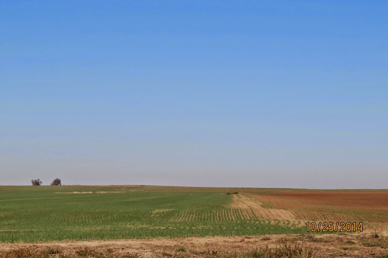
It was springlike, especially since many fields were newly planted. I thought it was all winter wheat, but on checking the Internet, I learned many crops are planted here in September and October, including clovers and alfalfa. The dirt is red, the skies blue and the fields green with the occasional oil rigs around which the farmers plough.
Oklahoma in late October - near Wichita Mtns. NWR

While I won't say Oklahoma is the most scenic state I've seen, the Wichita Mountains NWR area reminded me of the Charles Russell NWR in Montana. It is also a huge and rugged refuge of over 59,000 acres, established in 1901. Part is designated a Wilderness area, the Charon's Garden Wilderness. Hiking there is for tough and experienced hikers as trails wander about the mountainous rocky terrain, can disappear and/or cross game trails. Bison and longhorn cattle graze on the refuge so visitors are cautioned to "not approach too closely."

A handsome little bird, the Black-capped Vireo, is a focus here as it is now a threatened species due to habitat loss, in part due to the use of fire as a management practice, along with egg predation by the Brown-headed Cowbird. Interesting that prescribed fires have this consequence, which must also affect other species if done in nesting seasons and habitats.

While walking a small scenic trail to a deep blue lake (always a stunning visual in arid country), I dropped my Canon. It will need to go back for repair as a horrid clicking sound is the only function it now has other than the message: "Lens Error." Upon researching "lens error" on the Internet, at least half of the comments mention "dropped." Ughhhh....
Wichita Mtns. NWR - OK

BUT, I had my Nikon in the car, back from the Nikon repair factory, all cleaned and ready for use after I charged the battery. I haven't decided if that camera will do or not at this point. I REALLY like the Canon. Did I find comfort in that it seemed half of Canon owners also drop their cameras???? Actually, yes.

There is an area extending from southern Kansas, through central Oklahoma and into central Texas called Cross Timbers. Basically, it's the boundary between the wooded east and the open plains of the west. Washington Irving made a trip here nearly 200 years ago:

WWW.THISLANDPRESS.COM

If you’d have talked to Washington Irving the night before he set out from Fort Gibson on his 1832 romp through Green Country, you would have thought he was a five-year-old with a one-way ticket to Disney World. Wide-eyed and giddy, he waxed poetic in letters to family about “pristine wilderness” and “herds of buffalo scouring their native prairies.” I picture him sitting cross-legged on a bunk bed as he scribbled in his journal about the Cross Timbers, the hodgepodge of forest, glade and savanna that stood between the forests of the east and the prairies of the west. It must be at its perfection in the spring, he wrote, and he planned to cross it to continue toward present-day Guthrie.  
In late fall, Irving reached the forest and met reality. “We were kept for many weary days toiling through a dismal series of rugged forests,” he wrote. “I shall not easily forget the mortal toil, and the vexations of flesh and spirit, that we underwent occasionally, in our wanderings through the Cross Timber. It was like struggling through forests of cast iron.” Sheila Chapman is a trail guide at the Keystone Ancient Forest Preserve, a slice of the Cross Timbers that sprawls over the uplands of the east side of Keystone Lake. The preserve reportedly contains the spot where Irving had camped 179 years ago. She showed me her copy of the book Irving published a few years after he’d finished with Oklahoma, A Tour on the Prairies; Irving’s less-than-sterling review of the Cross Timbers starts in chapter 21. Sheila thinks Irving might have had a point with that whole “forests of cast iron” thing. “If you can, imagine trying to ride through this, especially on horseback, and in the kinds of clothes they wore,” she said. “I can just see it getting ripped to shreds.” Many of the branches Sheila and I cleared from the trail as we hiked fell from what might have been the very same trees that gave the progenitor of the not-so-red-blooded Rip Van Winkle and Ichabod Crane a new study on whining. In fact, the 1,300-acre tract is home to red cedar and oak trees that would have been mature growth when Francisco Vázquez de Coronado tore his way through the Oklahoma panhandle with his troops. 

Many of the visitors that signed the guest register in the VC were Hispanic.

There was a curiosity on the refuge, about a mile off the main route, that I had to check out. A sign said Holy City, and it turned out to be a collection of primitive red stone buildings, "Home of the Longest Running Outdoor Passion Play in America." A Congregational Austrian-born minister from the nearby town of Lawton started an Easter gathering here in 1926. It has been called the "Oklahoma's Oberammergau."

A lone bison grazed nearby.

Leaving the Wichita mountains, I drove north past a sign for the towns of Roosevelt and Apache, listening to classical guitar on the radio and reading historical markers detailing events of the Kiowa, Commanche and Apaches, and the US military.

I stayed Elk City, Oklahoma. It was 91 degrees and windy when I stopped for the night, and worked as an excuse for a motel. My room was on the second floor facing west. Just after a gorgeous sunset, with the skies still rosy, I looked out and saw dozens of Scissor-tailed Flycatchers twittering about the large trees on the edge of the parking lot, doing a pre-roosting frolic. It was one more Blue Goose vignette I will always remember.

Scissor-tailed Flycatchers - Elk City, OK


Wednesday, October 29, 2014

Blue Goose ~ Day 149

October 25, 2014 ~ Pratt, KS to Weatherford, OK

Other than the colors of the fields and foliage, it was like spring or summer this morning with warm sunshine and blue skies. I left Pratt late morning and drove south into Oklahoma, heading for the Salt Plains NWR. The land got noticeably more flat, as in utterly table-top flat. I remember the panhandle of Texas having this topography.
Western Oklahoma near Salt Plains NWR

This is Carry Nation territory, the bar-smashing zealot. There was a historical marker about her in Kiowa, Kansas where she "attacked" three saloons on June 1, 1900.

In fact, there were numerous historical markers, mostly about Native Americans and the military, but also of the the pioneers and the Santa Fe trail. And I was also near or on Route 66 occasionally. The traveler is constantly reminded of the past, all the while seeing the present in agriculture and ranching, and the oil industry with wells, rigs, storage facilities, trucks and processing plants never out of sight.

My impression remains of how arid this country was. I saw no water at all at Salt Plains except for the large Great Salt Plains Reservoir. All the creeks and marshes were dry so there were no easily seen birds other than small passerines. I drove to the VC which was closed on weekends and picked up a few free selenite crystals, one of the attractions of the refuge.

WWW.FWS.GOV:

Salt Plains National Wildlife Refuge is the only known site in the world where unique selenite crystals with hourglass inclusions are found. Because these crystals form in wet soil, sand and clay, particles are included within the crystal giving them their unique "hourglass" shape inside.  

It felt like a 1950s summer Dutch Sunday afternoon at the headquarters with inactivity, warm sun and the feeling of waiting for something to happen. A sign noted an underground Tornado Shelter, which is one reason I am glad I'm in Oklahoma this time of year rather than spring.
Salt Plains NWR - OK

But Salt Plains does have an abundance of wildlife. While I didn't see any on the reservoir, I only saw a small part of it. The birds undoubtedly were somewhere or will be, as this is a major migratory sanctuary with as many as 400,000 birds stopping by. It is also a breeding bird sanctuary for threatened western Snowy Plovers, American Avocets, and endangered Least Terns. Whooping Cranes use this refuge and geese alone can number 50,000. The birds come because of the water but also the food sources - the invertebrates, like salt brine flies that breed in the saline habitat. (I also saw these in thick clouds along the causeway to Antelope Island in Utah in the Great Salt Lake.)
But, I wondered if the dry marshes were a seasonal event or a man-made one? The auto route meandered through shrubs and mature trees, including Eastern Redcedars laden with their distinctive berry-like bluish fruit. (This cedar is actually a juniper BTW, and is an invasive species out here, spread by birds.)

I read that: "Tony Holthuijzen, a biologist who studied cedar waxwings – named for their fondness for eastern redcedar berries – found that it takes 12 minutes for a redcedar seed to pass through the digestive system of a cedar waxwing."

Trivia of the day...

I considered camping here but it was too early to stop, so went on south to Weatherford, a staging stop for the large Wichita Mountains NWR to the south. There was a Walmart on the edge of town. I walked a bit noting a lot of plastic trash in the adjacent fields but also a grand sunset. Perhaps Walmart could hire one person just to pick up the litter, generating local goodwill, in addition to doing the right thing since most of it comes from their stores. 

Along the route today, I passed an area with wind turbines in the process of installation:


Blades of a wind turbine waiting for installation...


Tuesday, October 28, 2014

Blue Goose ~ Day 148

October 24, 2014 ~ Emporia, KS to Pratt, KS

Relatively early this morning, I went to the Tallgrass Prairie National Preserve but the road through the refuge (which used to be drivable) got washed out, so now all exploration was restricted to walking, with advice and warnings about maintaining distance from the free-roaming buffalo or elk. One could, however, see the lay of the land from the highway. There were 6-8 buses of high-school kids here for a educational day, waiting to be rounded up for various activities, full of teenage energy when they weren't on their cell phones.
near Emporia, KS

Of the 170 million acres of tallgrass prairies, only 4% remain. Today, there are efforts in all the states that historically had these prairies to restore what they can. Agriculture was an ecological disaster for this land, arguably necessary or not. Perhaps a better balance will someday be achieved. The issues are entwined with the Native Americans and buffalo and the military and ordinary citizens and Manifest Destiny and the Homestead Act:

EN.WIKIPEDIA.ORG
The first of the acts, the Homestead Act of 1862, was signed into law by President Abraham Lincoln on May 20, 1862. Anyone who had never taken up arms against the U.S. government (including freed slaves and women), was 21 years or older, or the head of a family, could file an application to claim a federal land grant.

It was Friday, and I used points to stay in a Best Western in Pratt. It took a phone conversation with their customer services to guarantee this and, even though I was still charged an inexplicable $35 on checkout the next day, I received a call a few days later front the manager who deleted the charges and apologized. Why, oh why does this type of offer so often have to be proactively managed and doesn't just fall in place smoothly.

But before Pratt, I went to Quivira NWR. The name Quivira is Spanish and was given to the region by Coronado in 1541. I took back roads to get there, stopping to watch a Red-tailed Hawk eat a small snake. It was a warm sunny day; the refuge was just lovely as so many are, with Big and Little Salt Marshes and 14 miles of auto route. This is obviously snake country, and I did see some on the roads and thought about their presence whenever I got out of the van. About half our country has poisonous snake populations. People apparently adjust to that fact but it would take me awhile. Still, I would never run over a snake on purpose and did in fact swerve to avoid a couple.

The marshes had birds....many American Avocets, strikingly handsome even in the nonbreeding plumage of grey, white and black, peeps (small sandpipers), dowitchers, yellowlegs, grebes and ducks and herons.

American Avocets at Quivira, NWR - KS
The marsh grasses were gorgeous: golden and brown and rust-colored in the strong sun. It was a relatively wild place, somewhat remote, but with a sense of perfect natural harmony.

I wanted to get to the VC but misread the directions. I was worried a little about the red warning light for low gas so didn't turn back to find it and instead headed for Pratt. At one point I saw a farm machine approaching on the two-lane, taking up both lanes. The driver pulled to one side and I pulled to the other side so I could pass.

I had Mexican food in Pratt and then tried to work and watch game 3 of the World Series simultaneously. Of all major sports, I only like baseball. There is such elegance in the way the outfielders and basemen catch and throw the hit balls. I know the interest and emphasis this season has been on Madison Bumgarner, and usually is on pitchers, but I find the base hits and amazing outfield work thrilling with its moments of perfection and precision.
Kansas, between Quivira NWR and Pratt


Blue Goose ~ Day 147

October 23, 2014 ~ Beto Junction, KS to Emporia, KS

I had another good meal in the restaurant before leaving Beto Junction, reading a NYTimes magazine while lingering over coffee. The rain was diminishing as I headed west on I35 for Flint Hills NWR where I spent most of the morning. 

WWW.KGS.KU.EDU
The Flint Hills were formed by the erosion of Permian-age limestones andshales. During the early part of the Permian Period (which lasted from about 286 to 245 million years ago) shallow seas covered much of the state, as they did during Pennsylvanian times. Unlike the Pennsylvanian limestones to the east, however, many of the limestones in the Flint Hills contain numerous bands of chert, or flint. Because chert is much less soluble than the limestone around it, the weathering of the limestone has left behind a clayey soil full of cherty gravel. Most of the hilltops in this region are capped with this cherty gravel.
Because of the cherty soil, the land is better suited to ranching than farming. Because of this, the Flint Hills is still largely native prairie grassland, one of the last great preserves of tallgrass prairie in the country.
The tall grasses in this region are mostly big and little bluestem, switch grass, and Indian grass. Except along stream and river bottoms, trees are rare. The streams in the Flint Hills have cut deep precipitous channels. Streams cut in chert-bearing strata are narrow, boxlike channels, whereas those cut in weaker shales are wider, more gently sloping valleys.

Do not write off the prairie states as flat and boring. I never drive across them without thinking how amazing the skies must be at night or of the glorious sunrises and sunsets, of the changes in seasons and dramatic weather, of the grasses and flowers and fields to the horizon, and of the soaring hawks or grassland birds that live here; of the small towns that manage to survive with their two to three blocks of businesses, always with a bank and bar. Some are pleasant and restful; many are dusty and dated. I think of raising kids on these plains and how far the families drive to the nearest shopping areas and schools, of winter winds and roads, of cattle and horses and rodeos. The machines working the fields are often gigantic; daily crop and livestock financial reports on the radio along with more classical music than I hear in other parts of the country.

The skies have been spectacular most morning, seeing them a benefit of waking early in a cold car. Right now, the sun is rising at 8 a.m. and setting about 7 p.m.
My first stop at Flint Hills was a short boardwalk and trail along an extensive marsh and it was sparrow season!…with nearly constant birds flying in and out of the low brush. I especially noted the numerous Harris’s and Lincolns, but there were at least five other sparrow species…and a Spotted Towhee, Cardinals, Ruby-crowned Kinglets, Red-winged Blackbirds, many Mourning Doves, Blue Jays, Red-bellied and Downy Woodpeckers.
Harris's Sparrow at Flint Hills, NWR - KS
Also, right smack in the middle of the trail was a greenish-yellow grapefruit-sized fruit that I first thought was a kid’s ball. In the following days, I saw several of these, both on and off trees, and learned they are the fruit 
of the Osage Orange.
With the mild temperature, no wind, only the very occasional misting drizzle and all the bird activity, it was a perfect way to begin a day.  
The young man at the VC marked out an auto route through the refuge which went through marshes, most in the process of being pumped with water for the expected geese / duck migration. I passed two groups of White Pelicans but otherwise saw very few waterfowl.
White Pelicans at Flint Hills NWR - KS


The migrating geese won’t show up until a cold weather front brings them south, but I hope to see them further west…Snow and White-fronted Geese and (if I’m lucky) a Whooping Crane or two on their way to Aransas NWR or another venue along the Gulf but only if I’m blessed by the birding gods. 
Emporia, Kansas, was not far down the road and is very near the National Prairie Tallgrass Preserve. It was too late to go today, so I stopped in Emporia with all my familiar places nearby, including an unexpected Starbucks. I will stop there early tomorrow morning. 

Osage Orange fruits on Flint Hills NWR - KS

Blue Goose ~ Day 146

October 22, 2014 ~ Omaha, NE to Beto Junction, KS

When I asked at Starbucks the next morning if they had found a memory card, they said no, so I was surprised to find it on the floor right by the chair I sat in yesterday. Obviously, the floor didn’t get swept overnight. The card is only an inch square but was in plain sight. 
The sun was shining brightly as I drove due south for several hours before pulling into a truck stop in the middle of nowhere in a place called Beto Junction at the intersection of US75 and I35. It was early afternoon, very busy with trucks coming and going, but I was tired and hung out in the van for a few hours, reading and taking a nap. I love stopping at venues like this when traveling, places with hundreds miles of prairie out the window, not urban or even suburban. There was a single motel (the Wyatt Earp) with a life-size buffalo sculpture on the lawn. It wasn't a hard decision to stay the night (but not in the motel). 
Semi drivers intrigue me…What about their lives apart from the road, the long days of driving, the kind of money they make, the companies who hire them, their trucks which vary from ordinary and generic to highly polished with gleaming chrome and bright paint; how do they maintain a healthy lifestyle should they wish to do so? Some drivers have dogs also. Some are African-American but most Caucasian. One cattle truck idled for 30 minutes right in front of me, with the cows inside making small clicking noises as they jostled in their confined space. In my experience, the drivers are quiet, go about their business, drink a lot of coffee, use these stops for what they need and move on through wonderful sunny dry days but also through cold wet nights and tornado alleys and snow in the mountains...and heavy traffic near big cities, always aware and watchful of passenger cars and RVs and smaller trucks, on roads where deer are prone to jump onto the highway. There was a steady movement of trucks exiting directly in front of my van, but it wasn’t bothersome or annoying. The noise is a given of course, but it becomes white noise (for me anyway). After hours of this, they started to seem like gigantic mechanical explorers heading into an alien world. With such a constant stream of them, it came surreal.
The store was orderly and clean with few offensive products. There is often a small revolving bookcase in these places with titles of faith and self-betterment, or westerns. Lots of trucking products for minor repairs, some clothing, items for smart phones and other screens, fast food, beverages (but no alcohol) and small packages of dog food. The never-ending country music on the overhead is interrupted with the shower announcements. One of these days, I'm going to try this option.  
I ate in the attached Country Pride restaurant and had good food…real chunky mashed potatoes with good brown gravy and a lean hamburger steak with onions and mushrooms, with the veggie component from an adequate salad bar. I figured that Kansas would have good beef, and it did.
Late in the afternoon, clouds moved in with a forecast for 100% rain by midnight. I closed all the windows, and it did indeed rain hard, but I was completely comfortable and warm in my new sleeping clothes, feeling totally tucked in. The rain masked the truck noise and I slept well. I did put up a couple of window shades on one side which also helped reduce the fish-bowl feeling I sometimes have. 

Friday, October 24, 2014

Blue Goose ~ Day 145

October 21, 2014 ~ Stuart, IA to Omaha, NE

I woke early so sat in McDonalds for a couple of hours, which my second choice venue for WiFi, but it's hard to find a menu item not loaded with salt and fat.

The sun rose in the east but I was driving west. There isn't much better than being on the prairies in the early morning. I did pull into a scenic overlook near the Missouri River and changed into jeans and took photos of a impressively large Eastern Cottonwood.
Eastern Cottonwood in October in Iowa

I got to DeSoto NWR by 9:00. This a Missouri River refuge consisting of a 7-mile oxbow lake created by the ACE (Army Corps of Engineers) in what is called a "channelization" project. The western boundary of the refuge is the Missouri River; the rest of the boundary is C-shaped Lake DeSoto. The Missouri often rampages in the aftermath of spring melt, especially in years when snow piles up in the Rockies and eventually finds its way into the Missouri. Existing channels disappear; new ones are formed. Oxbows are created; flooding happen; roads close; land is inundated. The big river are the playgrounds of the ACE. I drove from west to east in the spring of 2011, spent hours trying to find an open bridge across the flooded Missouri and was finally was directed to an old rickety steel bridge in a town whose name I've forgotten. On the Iowa side, I drove on a two-lane just inches above flooded fields...thousands and thousands of acres. Interstate 29 was closed for a long time due to water.

Today was a real wild goose chase as the Snow Geese had not yet arrived from the north. It has just been too warm for them to leave, although they often here in the thousands by mid-October. But I did see several handsome Harris's Sparrows. These are a rarity in Michigan, only one or two showing up every year in the southwest counties. (And actually, there is one hanging around in Berrien County right now.)
Harris's Sparrow at DeSoto NWR - IA

Another surprise was the beautiful steamboat museum in the Visitor Center, a tribute to the many steamboat catastrophes in general and the Bertrand in particular with thousands of artifacts, all presented artistically with meticulous care. So, next time you visit western Iowa, DeSoto is worth a stop. It is exceptional in the same way I felt the New Bedford Whaling Museum was - a fascinating glimpse into the history and culture of those times. The Bertrand was headed up the Missouri with destination the newly discovered gold fields in Montana.

WWW.FWS.GOV


DeSoto National Wildlife Refuge, located near Missouri Valley, Iowa, is home to a premier archeological collection of over 250,000 artifacts excavated from the buried wreck of the Steamboat Bertrand. On April 1, 1865, the sternwheeler hit a submerged log, thirty miles north of Omaha, Nebraska. Bound for the newly discovered goldfields of Montana from St. Louis, Missouri, the Bertrand sank into the depths of the Missouri River; and after initial salvage efforts, her cargo was written off as complete loss. 
Using historical documents and a flux gate magnetometer, modern treasurer hunters, Sam Corbino and Jesse Pursell located the wreck on DeSoto National Wildlife Refuge in 1968. As the boat was on federal property, the salvors agreed under the requirements of the American Antiquities Preservation Act of 1906, to turn over all recovered artifacts to the U.S. Fish and Wildlife Service for permanent exhibition and preservation in a public museum. 
By 1969, the vessel's cargo was completely excavated from its thirty feet deep, mud tomb. Unfortunately for the salvors, the treasure they sought had eluded them. Insurance company divers had apparently removed most of the mercury and other valuables soon after the ship sank. However, what had been left was a diversity of tools, clothing, and food items. The Bertrand's cargo was remarkably well preserved and the refuge's collection is a unique time capsule for researchers and visitors interested in America's 19th century material culture.

While driving in the refuge, one can actually see the excavation site, now a mile from the Missouri. While the work was in progress, water pumps ran 24/7 to keep the site from flooding. All very interesting and the type of unexpected exhibit one finds on some of the refuges.

DeSoto NWR - IA
The land is flat with fields, wetlands, riparian woods, DeSoto Lake and, of course, many cottonwoods which are actually a "soft hardwood." It was another mellow day. I walked around the Bertrand site, watched a hawk or two overhead and a few distant geese and ducks and busy sparrows. I intended to stop along the road at a birdy site for an hour, but the biting flies moved me along.

And I crossed the river to Boyer Chute NWR in Nebraska:

 EN.WIKIPEDIA.ORG
Boyer Chute National Wildlife Refuge, created in 1992, is a National Wildlife Refuge (NWR) located along the banks of the Missouri River in the U.S. state of Nebraska.[2][3] The 4,040-acre (1,630 ha) refuge preserves an area that had been cultivated and neglected before the early 1990s.[4]  
Channelizationprojects along the Missouri River to improve flood control and navigation resulted in the closing off a side branch of the river, known since the early 19th century as Boyer Chute. Between 1820 and 1937 the Missouri River had migrated 3 mi (4.8 km) eastward and the area of the chute had originally been on the east bank of the river; today, the chute is west of the main channel of the Missouri.[4] In 1937, the Army Corps of Engineers began to rechannel portions of the Missouri River, cutting off the chute to flowing water. Overgrowth and cultivation took over the lands now preserved in the refuge. Restoration of the area commenced in 1993; this included planting 9,100 native plants and trees and restoring the inflow to the chute from the main channel of the Missouri River.
Today, the refuge is home to dozens of mammal species, including White-tailed deerbeaversopossum,raccoonbobcatfox and coyoteBald eagleheronduckBelted Kingfisher and hawks are known to inhabit the refuge.[4] Restoration projects also improved sport fishing opportunities by providing better breeding habitat. The refuge is along one of the primary bird migration routes in North America; the population of migratory birds increases substantially during spring and fall months...During low water flow levels along the Missouri River in the late fall and winter months, the chute may have little or no water in it. Hunting is allowed in season with a permit and there are several fishing piers. No pets are allowed in the refuge.[4]
 
The refuge sustained extensive damage during the 2011 Missouri River floods. As of Spring 2012, the refuge roads remained closed and no date had been determined for when they would be reopened. 300,000 dollars has been requested to remove six flood damaged structures in an effort to get the refuge reopened. Planners indicated that structures may not be rebuilt since there is no method to protect them from future flooding events.[

I googled a Starbucks south of Omaha and found one which happened to be right across the street from an Applebee's and a Walmart. I had intended to continue south for awhile but didn't and opted for the easy plan of stopping for the day, an advantage of traveling with a loose agenda. I bought sweat pants and sweatshirt in Walmart for sleeping for $7 each….and a new memory card since I couldn’t find my other one after I had uploaded the days’ photos in Starbucks. I had eaten at Applebees so the card was somewhere in the vicinity of south Omaha…in my van, in Starbucks, in the restaurant, on the sidewalk….


Lake DeSoto NWR - IA

Thursday, October 23, 2014

Blue Goose ~ Day 144

October 20, 2014 ~ Iowa City, IA to Stuart, IA

Coralville which was just west of Iowa City had a convenient Starbucks, so I stopped for a couple of hours before driving to Neal Smith NWR.

WWW. FWS.GOV
The mission of the [Neal Smith] Refuge is to actively protect, restore, reconstruct and manage the diverse native ecosystems of tallgrass prairie, oak savanna, and sedge meadow. These were the native habitats existing on the Refuge’s 5600 acres prior to Euro-American settlement. 
The staff works at these goals using the historical land practices of fire and grazing buffalo, along with replanting native grasses and flowers and removing invasive species. Neal Smith has an impressive Prairie Learning Center. As I drove into the parking lot, sparrows were feeding on the tall grasses along the edges. When they landed on a stem, it would bend over, but the birds hung on, swinging gently as they fed.
Neal Smith NWR - IA

It was nearly closing time, so I walked quickly through the exhibits and then drove refuge roads,  seeing elk but no buffalo. The sun was low, lighting the golden, brown and rust-colored grasses.

The great old Eastern Cottonwoods in the bottomlands had summer green or fall yellow leaves in nearly equal parts. All was peaceful on this late afternoon. The prairies were a lovely messy tangle of dozens of species, always full of light and subtle colors.
Elk on Neal Smith NWR - IA


I slept in a truck stop near Stuart, an I80 exit, behind one-half of a double-wide trailer whose driver had also stopped for the night. The other half was in another spot, along with the accompanying vehicles announcing "Extra Wide Load." The Interstate truck stops are busy but preferable to Walmart lots, partly because I can usually find a place that is not overly lit up. Sometimes I can almost read without an LED light in the Walmart lots. And the people are travelers like me, going places, coming from places, just wanting a safe and free spot for the night.

Blue Goose ~ Day 143

October 19, 2014 ~ Sun Prairie, WI to Iowa City, IA

Since I was having trouble uploading photos to my laptop using a cable, I bought a card reader in Walmart so I could upload that way if necessary but then also found a Best Buy in Madison where I spent 90 minutes with the Geek Squad guy and the camera guy, neither of whom could figure out why my cable / camera wasn't working. The camera was still under warranty and the best they could offer was to send it back to Canon. It would be gone for 2-4 weeks which was not acceptable. I did discover that the memory card didn't need a reader and plugs right into the Mac...which I did, and the photos downloaded perfectly. Such is the elegance of Apple computers.

As I was leaving Best Buy, a dad with two small kids (about 4 and 5 years old) were coming in, and I heard him say: "Please, please gentlemen, do not touch anything."

I then returned the card reader to Walmart and was on my way, driving in sunshine through Iowa most of the afternoon, up and down a scenic landscape of long open hills. I have always like this state. It seems benign, prosperous and self-contained. Many of the fields had dried corn stalks and huge farm machines moved slowly in the fields. The distant farmhouses on the hills were generous and tidy with large hardwoods or evergreens in the yards. For awhile at least, I was leaving the busy roads behind. The horrible smell of CAFOs did occasionally disturb this bucolic drive, but only for a minute or two.

Using Priceline, I reserved what I thought was a good deal in downtown Iowa City, but I had to pay to park and had a light supper that was truly awful. The soup I ordered was shrimp and white bean. The broth was water-based with cayenne to spice it up. The shrimp were the little canned circular ones that look like grubs; the white beans looked like large chickpeas. There was probably a stray diced veggie in this mix which mostly settled in the bottom. The Caesar salad nearly overflowed the large deep cereal-type bowl in which it was served and consisted of big chunks of iceberg lettuce, large croutons and some shaved strips of hard cheese. It was impossible to cut the lettuce without stuff spilling out on the table. But the wine was delicious. When asked the next day "How was your stay?" I mentioned the horrible food and was offered a free breakfast which I declined as I was checking out.  (This is so whiny and trivial, I know....)

But the bed was heavenly...

(I had emailed a college roommate who lives here but never heard back from her.  I know she isn't an avid social media participant or perhaps she was out of town. I drove by her house the next morning on my way out of town. It was lovely (as I figured it would be) with political signs in the front yard, a stained glass piece in the front door and many bird feeders in an established neighborhood defined on three sides by a large bend in the Iowa River. )


Wednesday, October 22, 2014

Blue Goose ~ Day 142

October 18, 2014 ~ Beaver Dam, WI to Sun Prairie, WI

There was supposed to be a Bird Hike at 10:00 at Horicon but no one showed, so I drove the auto route again, photographing ducks and grebes. The sky was dramatic with alternating sun and clouds.
Pintail at Horicon NWR - WI

It was Ding Darling day at the Visitor Center and I stayed for a couple of hours, mostly to hear a Power Point presentation by Tim Eisele.

Jay Norwood Darling (he was born in Norwood, Michigan) was a cartoonist for the Des Moines Register by profession and was responsible for the Duck Stamp program which began in 1934. The monies generated by annual duck stamp sales fund much of wetland projects on the refuges and are required for duck hunting. The stamps currently cost $15. There is a contest each year to choose a painting for the stamp. Mr. Eisele had judged the contest one year, along with four others, who had to pick a winner from over 500 entries. The USFWS chooses five waterfowl species each year and the artists need to work with one of them.

WWW.FWS.GOV
Fortunately, the sale of stamps is not restricted to hunters. Anyone can purchase the stamp, which can be used as an annual "season pass" to national wildlife refuges charging entrance fees. Conservationists buy the stamp because they know that 98 cents of every dollar invested in the stamp permanently conserves wildlife habitat for future generations; a small investment will bring you and your family long-term returns. Philatelists purchase the stamp as a collectible—a $1 stamp purchased in 1934 may bring as much as $750 for a stamp in mint condition today.

There are also Junior Duck Stamp contests now in every state, and the current winners are exhibited on various refuges.

I tried to find a place to download my photos while I waited but had problems.

So, while I hadn't thought I would be interested in a presentation of "Gardening with Native Species," I sat in on the last half and wished I had heard the whole thing. The presenter, Mike Yanney, works at Johnson' s Nursery in Menominee Falls, Wisconsin and owns an JN Plant Selections, "offshoot" company. He was a lighthearted, knowledgable speaker, showing slides of native trees and bushes as he spoke, with delightful and curious facts about most of them. He obviously loves his work, reminding me of the presenter at Lostwood NWR last June who talked about mud puppies. For sure, the right person can make anything interesting. His slides weren't especially crisp or clear, and he spoke in an unassuming manner, but he had a way of communicating that grew on me as he talked about Chinkapin Oaks, Bur Oaks, Leatherwood trees....and many other species. Unfortunately, I missed the flower portion of his talk.

It was now sunny but chilly. I drove to Sun Prairie, WI, where I found a Starbucks and tried to figure out the problem with my photos not downloading (didn't) before I drove in the dark to a Walmart. I woke up at 0345 because I was cold (it was 30 degrees) and I had to pee. I figured this was the third nadir-night of the trip, but 3 of 142 isn't bad...only a 2% rate.

Wilson's Snipe at Horicon NWR - WI

Sun Prairie is a dozen miles NE of Madison with upscale neighborhoods and shopping malls in various stages of construction.

Blue Goose ~ Day 141


October 17, 2014 ~ Marquette, MI to Beaver Dam, WI

The weather had not cleared in the morning, and it continued to drizzle most of the day as I drove south from Marquette on Highway 35, a road never taken before. In only a dozen miles, I suddenly arrived at the open pit Empire iron ore mine which was HUGE. The Upper Peninsula has three iron ranges which have provided jobs for thousands and iron for all of us, but open pit mining is incredibly ugly:

WWW.WXPR.ORG 
Standing on the edge of Empire Mine is like looking into an amphitheater far too big for any performance.  It’s a mile wide and a mile across.  1200 feet deep.  

The concerns about heavy and toxic metal contamination (mercury and selenium at this site), the nearly irremediable disruption of the land, the high use of water and diesel (trucks can use 1000 gallons a day) and air quality accompany this type of mining. The Empire and the equally large and adjacent Tilden mines are owned by Cliffs Natural Resources, an interesting name, the "Natural" part apparently added later. Check out the images at:

WWW.EARTHOBSERVATORY.NASA.GOV 
 In 1844, government surveyors were exploring rugged, lake-filled terrain near Negaunee, Michigan, when they noticed their compasses swung erratically in certain areas. It did not take long to determine why: ancientPrecambrian rock layers in the area were laced with bands of iron ore. The surveyors had discovered the Marquette Iron Range (called the Negaunee Iron Formation by geologists), and the area would eventually become one of the most productive sources of iron in the United States.
Within a few years, several companies were competing to mine, ship, and process the magnetite and hematite ore in the area, which was so abundant and accessible that chunks could be pulled off the surface and shipped directly to steel mills with little or no processing. But by the 1950s, most of the easily accessible ore with high concentrations of iron was gone, and mining companies had to dig much deeper and develop new techniques to extract and concentrate iron from lower-grade ore. 
Today, mine operators in Michigan’s Upper Peninsula are generally after taconite, a low-grade ore that was once considered waste rock. To make it usable, mining companies blast it into small pieces with explosives, grind it into powder with powerful machinery, and then use magnets or flotation techniques to separate the iron minerals out from the surrounding rock. Iron-rich powder is then mixed with water and clay into a slurry that is shaped into pellets, heated, dried, and shipped to steel mills. The pulverized waste rock—known as tailings—is loaded into water-filled retention basins, where it eventually settles to the bottom and re-enters the rock cycle.

I find these mining issues fascinating when considering the lives of workers and their families, possible alternatives to this kind of mining, the products that use iron and corporations that own the mines. Of course there are not easy answers, and constant monitoring to ensure that the owners do whatever possible to mitigate the harmful effects is the often thankless job of environmentalists and conscientious politicians. Fair or not, I always think of this as a Republican / Democratic divide.

Empire and Tilden are one end of a natural landscape spectrum and the next several hours were the other end as I drove through thousands upon thousands of yellowing larches, the only deciduous conifer, with needles grow in small tufts on the branches. This species predominated but there were also spruce and cedar, maple and birch. Again, even on a gray and gloomy day, the trees gave me a sense of contentment.

Larches along Highway 35 in the UP - MI
Always checking out houses as I drive, there was an attractive one in the small town of Gwinn, appealing as it was on the main street with a lovely boulevard. But Gwinn is hundreds of miles from anyone I know....

The road eventually ran along the shore of Lake Michigan with modest homes and an occasional small park. It passed Arthur Bay which did not seem any different from the shores to the north or south in that there was no discernible "bay" that I could see. I like this area; it had little loud tourist distractions.
Lake Michigan north of Green Bay - MI

On down into Wisconsin and around Green Bay to Horicon Marsh, another refuge I was seeing for the second time. I drove the auto route in late afternoon...with sun and cloud combinations highlighting the beauty of an autumnal marsh. I think of these days as pre-Thanksgiving weather, very evocative...the transition between hot summer and cold winter.

I stayed in Beaver Dam in a motel with VERY unstable Internet. When I complained (I was trying to work), the girl at the desk acknowledged that, "They know about this; it's been a couple of days and they are working on it at the other end...." End of discussion....

Dinner was spaghetti in a nearby restaurant, a Garrison Keillor set piece on this Friday evening.


Horicon NWR - WI


Monday, October 20, 2014

Blue Goose ~ Day 140


October 16, 2014 ~ West Branch, MI to Marquette, MI

Goodbye to summer and warmth. I needed to rearrange things in my van so I don't freeze at night and instead of sleeping ON the sleeping bag, I now crawl into it and add blankets on top. Sort of OK...

West Branch seems to be a gateway for Up North, and a gift shop attached to a restaurant where I ate a pretty dismal breakfast (a huge plate of mostly fatty chunks of corned beef and a few fried onions and peppers under two pallid eggs) had a large selection of touristy tchotchkes, many with the theme of drunken women ("Boozie Floozie"), along with black bears, the Great Lakes, hunting, cabins....

I75 up to the bridge was stunning with color, even under cloudy skies. Yellows and oranges predominated, but there were occasional brilliant reds, lime greens and all the browns and chestnuts of the oaks. Certainly the vistas rivaled those anywhere in New England and with way less traffic.
Along I75 near the Big Mac Bridge - MI

Particularly lovely were the bright yellow leaves of the quaking aspens moving in the slightest breeze, a silent tingling, and Maria's favorite tree.

I crossed the bridge and headed west along Lake Michigan, which was very calm today, and drove the auto route at Seney NWR. I had been here in June, and knew how lovely it is, so did a fall reprise...driving very slowly through seven miles of marsh and color, under grey skies with a modest number of waterfowl moving about. It was like a new cover of Gray's Sporting Journal as I rounded every curve, revealing another marsh or pool. Yellow leaves were floating down even without much of a breeze. Somewhat surprisingly, there were more vehicles today than on my summer visit.
Seney NWR - MI

I continued north from Seney and then west to Marquette along the shore of Lake Superior and through the Hiawatha National Forest. There was intermittent drizzle all the way which didn't diminish the wild beauty of this part of Michigan.

I was actually taking a long route to Iowa through the Upper Peninsula, but I just could not start out again and navigate the heavy traffic near Chicago. I realize I am traffic-phobic.

I stopped at one of the only Starbucks in the UP (the only one?) and sat two feet from a couple of students who were studying viruses and whose vocabulary brought me back to my days in the lab. Of course, with Ebola constantly in the news, they were having immediate knowledge of the power of a virus.

Speaking of Ebola...I am just now beginning to hear questions about how long this virus can live outside of the human (like on a hard surface, for instance), or how EXACTLY is it transmitted (like must one have an open skin lesion or breathe in viral particles or what exactly?)  and it is true that a person is not able to transmit the virus if he/she has no symptoms? and how soon after a fever begins is an infected person contagious? I read that even the scientists really don't know enough (at this point) about Ebola. And there are the heart-rending stories and photos from western Africa that contrast with the real-time situation in the US (hysteria), which is probably making me dis-believe in politics and politicians more than any other issue - the fact that these men and women can use Ebola to further their chances of getting elected (re-elected). Supposedly intelligent folks....Republicans and Democrats. We are a nation of science naysayers.

I slept well cocooned in my car while the windows misted from the drizzle. But I have not mentally prepared for the fewer hours of  daylight. Like, what am I going to do when it gets dark at 5 pm and stays dark until 8 am?

Seney NWR - MI


Thursday, October 16, 2014

Blue Goose ~ Day 139


October 15, 2014 ~ Holland, MI to West Branch, MI

After several days of sleeping in comfortable beds, I (somewhat reluctantly) resumed my Blue Goose Adventure. I had coffee with Dave and then looked at a house near Kollen Park that I saw on Craig's List, but it was 100 years old (for one thing) and now was not the day to impulsively buy a home.

I finally got going early afternoon and drove across the state to Shiawassee NWR just south of Saginaw. It was a stunningly beautiful refuge...perhaps in part because of the time of year and time of day, but the variety of habitat certainly attracted birds. I saw American Widgeons and Gadwalls and Trumpeter Swans; a juvenile Common Gallinule; a dozen Pied-billed Grebes; an immature Bald Eagle and Red-tailed Hawk...more ducks, geese, egrets, gulls...a Great Blue Heron, blackbirds, sparrows. The weather was unsettled with heavy dark grey clouds and I moved through the refuge in intermittent light rain, but then the sky began to clear in the west. The sun lit the marsh in the east and a rainbow appeared.

Wood Duck pair at Shiawassee NWR - MI
The auto route was six miles, mostly on the levees and over a couple of spillways, with many opportunities for seeing and photographing birds. Four rivers (Tittabawassee, Shiawassee, Cass and Flint) meet in this area, historically known as The Flats, so there is a lot of water, and thus, an abundance of waterfowl habitat. I love these refuges which are relatively close to big cities and which are havens for wildlife and those humans who need a respite from urban life. No telephone poles and no overhead wires; no billboards; no houses or barns; no pavement, and the occasional vehicle is either a USFWS truck or another birdwatcher / photographer.

Just watching the Common Gallinule poking along the edge of the cattails for several minutes, the swans flying low with their long white outstretched necks and the many grebes and widgeons made this a great stop as I get back into it all....especially since I haven't been on too many refuges thus far with many birds. The trees in the wet and flooded woods had brilliant fall foliage. Even the grasses and reeds were often golden.
Shiawassee NWR - MI

Maria always wanted to get to Shiawassee We actually had plans the spring she died, but she just was too sick and none of us went....so this was a tribute trip also...dear Maria, who would have reveled in this beautiful place.

I figured I could get to West Branch by dark which I did (barely) and ate for $11 at a Ponderosa, which had a buffet with just about every kind of comfort food I've ever eaten. I had chicken noodle soup, meatloaf, cheesy potatoes, green beans, baked beans, carrot cake and a brownie. Too much food but fairly tasty. I wish I could have ignored the incredibly obese woman at the next table. I heard on the radio today that 66% of Michiganders are overweight and 33% are obese and that Michigan ranks #6 in obesity in the nation.

The adjacent Walmart parking lot had no trees. I changed places about five times before finally settling in. I woke up at 3:30 and read for a awhile but soon went back to sleep. When I woke the next morning, a large RV had pulled in close to me sometime in the middle of the night.

Wednesday, October 15, 2014

Blue Goose ~ Day 126 - 138

October 3 to 14, 2014 ~ Indiana and Michigan

Another respite with family...

INDIANA

- guided sparrow hike on a windy morning with DHC
- Rick's Boathouse luncheon at Eagle Creek
- stunning fall foliage everywhere
- walking with Tino who likes me (finally.....)
- preview of wedding site at Ft. Harrison

October Birding Hike - Indianapolis
MICHIGAN

- Holland State Park
- Dave and Ellen's lovely home (3 nights)
- Tony's cottage on the shore of Lake Michigan
- geocaching adventures with Ess, Eunice and DHC in the dunes and woods and mucky swamps, avoiding thorny brush and maneuvering through cattails and on lovely wooded trails with many successes and one grand failure
- Eunice as head chef producing delicious meals
- extended family on Saturday
- knitting, reading, talking, hiking, music by DHC and Eunice
- Art and Wine (which didn't happen but maybe next year)
- chopping for Autumn Vegetable Soup (which Eunice calls Gypsy Soup)
- lazy coffee mornings
- Boatwerks dinner on Black Lake
- truly, truly exquisite weather for three days in a row
- sleeping in moonlight
- remembering Maria


- Tesla's 2-year-old birthday
- sweet smiling Duncan
- chattering red-haired Joey and his Thomas toys
- four generations


Thursday, October 2, 2014

Blue Goose ~ Day 125


October 2, 2014 ~ Seymour, IN to Columbus, IN

Muscatatuck NWR was five miles away and I wanted to finally get to a refuge early in the morning for once instead of mid afternoon, the hottest part of the day, the quietest for birds. 

First though, I had an early pre-sunrise breakfast at Burger King and watched CNN, a nice change from FOX which is usually the choice in public places in the Midwest (or sports). I listened to the latest on Ebola in Texas, wondering how a nurse (or anyone in that first ER visit) could have neglected to recognize that a sick person, recently from Liberia, might not warrant suspicion of Ebola. Like not rocket science here....

I loved Muscatatuck. It will be on my list of top ten favorite refuge, for now at least. I did get there early and spent four hours on an auto route, working hard for, but eventually seeing, 26 species of birds. There was no wind, it was just warm enough and the road went through a variety of habitats.
Muscatatuck NWR - IN

A few other cars came by; one couple was out with a long-lens camera, photographing Red-headed Woodpeckers and whatever else showed up. I stopped also, and it turned out to be a very birdy spot as all sorts of passerines showed up, which are birds with the following characteristics: 


BIRDING.ABOUT.COM

  • Small to medium body size.
  • Relatively vocal, including different calls and often elaborate songs.
  • Altricial chicks that need extensive parent care after hatching.
  • Relatively bright colors or distinct markings.
  • Unwebbed toes and feet.
  • The most prominent characteristic of passerine birds, however, is the anisodactyl arrangement of toes. These birds have four toes, three facing forward and one backward, which allows the bird to easily cling to both horizontal and nearly vertical perches, including branches and tree trunks. These birds also have an adaptation in their legs that gives them extra strength for perching, and in fact, the relaxed position of their feet and talons is to be clenched securely, so the birds are able to perch easily even when sleeping.

Cool word, altricial: Humans are considered secondarily altricial...

I walked the mile-long Turkey Trail through the woods, saw a Wood Thrush and twice just missed getting hit on the head by falling black walnuts, which are greenish and nearly the size of a baseball and which were dropping constantly all through these woods.  As were leaves...gently wafting down, often getting caught on branches on their way, and teasing as the movement mimicked a bird flit.
Cardinal at Muscatatuck NWR - IN

A small group of Killdeer on a mud flat with two Canada geese; several Eastern Phoebes, with yellowish bellies this time of year; many Carolina Chickadees....warblers and woodpeckers...ducks in the distance on the bright-green algae-covered impoundments.
Muscatatuck NWR - IN

The Visitor Center had hundreds of nature books, several very active bird-feeders, and interesting, informative, modern exhibits. Muscatatuck was all a refuge can be for visitors, and I appreciated the work that is required to create and maintain the roads, trails, lookouts and boardwalks.

By mid afternoon, I headed north on I65 to Columbus, not far from Indianapolis, and found a Starbucks...and here I am, ready to read for awhile, find the nearby Walmart and then (maybe) organize the inside of my van.

There were ponds behind the usual businesses (Menards, Walmart, several fast food restaurants, gas stations) and beyond those were fields of dried corn stalks. It was peaceful except for nearly constant skeins of Canada geese flying very low and loudly just over my head, but the sound of birds is welcome when the auditory alternative is traffic. And the skies of autumn are often pearly grey with subtle pastel colors in the early evenings on warm days.

I went to about four fast food restaurants, eating something at each one, trying to find something satisfying...and failed. The last one was a Culver's where I wanted an old-fashioned chocolate malted which they assured me they made...but it was totally not....

I think this particular stretch of Indian Summer is about to end but it's been wonderful!

Muscatatuck NWR - IN